Scientists unearth Port Macquarie Coastal Geotrail
More than 460 million years of history are accessible for the community to explore following the unveiling today of the Port Macquarie Coastal Geotrail, a collaborative project led by University of Newcastle researchers.
Geotrails provide a unique tourism experience by guiding visitors on a journey that focuses on the local geology, allowing volcanoes, sea animals and ocean currents to help tell the story of the past.
Project leaders, Conjoint Professors Ron Boyd and Robin Offler instigated the Port Macquarie venture, which is designed to promote an understanding of earth sciences by enabling people to explore the natural environment and learn about its diversity.
“This geotrail project brings together the well-known beauty of the Port Macquarie coastline with the less well-known story of the area’s unique and spectacular rocks,” Professor Boyd said.
“There are not many places in the world where you can travel on a journey equivalent to starting in the eastern Pacific Ocean at a volcano, encountering microscopic sea creatures passing by Hawaii, going down an ocean trench off Japan and ending up 100km below the Earth’s surface.”
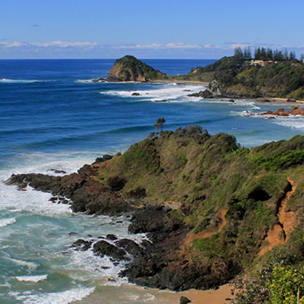
Stretching for almost 4km between Shelly Beach and Rocky Beach, the geotrail provides a unique scientific recreational experience for the local community, including school groups and visitors to the Port Macquarie–Hastings region.
A free self-guiding mobile phone and tablet app, developed by the University of Newcastle researchers and the Geological Survey of NSW, support the geotrail story.
Educational opportunities for school students and the public will also be supported by signs along the walk and a website developed by the Port Macquarie Hastings Council, including maps and more in-depth explanations.
“Tourists and students will be able to gain a new appreciation of the Port Macquarie coastline and its unique geological features – by exploring its rocks,” Professor Boyd said.
“The rocks on this geotrail have formed as a result of activity by volcanoes, microscopic marine animals, ocean currents, and extreme temperatures and pressures, kilometres below the Earth’s surface. The geotrail successfully demonstrates the theory of plate tectonics and how the Earth’s crust was formed, a key underlying concept in earth science.”
The collaborative geotrail project was led by Conjoint Professors Ron Boyd and Robin Offler of the University of Newcastle, and supported by the Department of Planning and Environment (Geological Survey of NSW and National Parks and Wildlife Service), Port Macquarie-Hastings Council and Birpai Local Aboriginal Land Council.
Geological Survey of NSW Executive Director, Dr Chris Yeats said the Geological Survey of NSW was excited to be involved in the collaborative project that aimed to improve the community's understanding of the unique geology of the coast near Port Macquarie.
“The Port Macquarie Geotrail is just the latest example of a number of geotourism projects that GSNSW has supported in recent years, including the Gondwana Coast Fossil Walk in Ulladulla, and the production of free self-guided geotourism maps of Broken Hill, Cobar and the coastline at Newcastle.”
The mobile app is available on Android and Apple and the Geotrail website gives further information.
A brochure including a map of the geotrail tells the story of how the area was formed and highlights the geology along the way, so visitors can identify various rock formations and learn how they came to be formed. The brochure is available for download or is free at the Sea Acres Rainforest Centre, 159 Pacific Drive, Port Macquarie.
Related news
The University of Newcastle acknowledges the traditional custodians of the lands within our footprint areas: Awabakal, Darkinjung, Biripai, Worimi, Wonnarua, and Eora Nations. We also pay respect to the wisdom of our Elders past and present.