Centre for Geotechnical Science and Engineering
Proximity Remote Sensing and Continuous Monitoring
Key Researchers: Klaus Thoeni, Anna Giacomini, Stephen Fityus
PROBLEM DESCRIPTION
Rigorous geo-hazard management practices require accurate spatial data to classify the type of instabilities, monitor their activity and predict their evolution. Non-contact remote sensing techniques, such as laser scanning, photogrammetry and inSAR systems, allow surveying slopes and geostructures with very restricted access, covering wide areas and tracking deformations in almost real-time. However, current monitoring systems are quite complex and costly, and more cost-effective and smart solutions that allow capturing all types of instabilities with real-time updates are still required. Additionally, the integration of such solutions with real-time precipitation measurements is essential to better understand the interaction between triggering events and failure and to provide effective and reliable early warning systems.
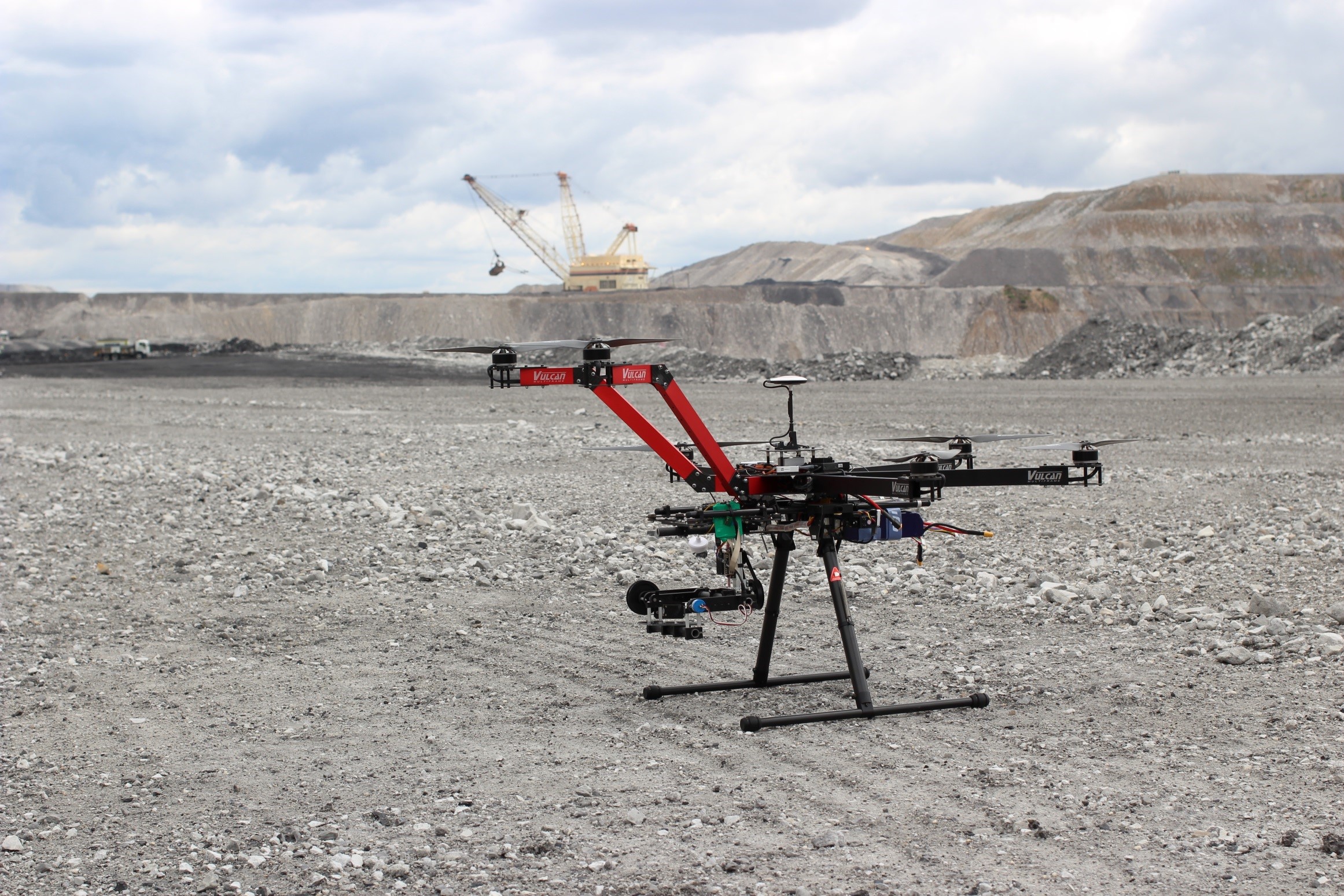
Recent advances in unmanned aerial vehicles (UAV), such as electric multirotor helicopters or multicopters, combined with sophisticated sensors (e.g., multispectral imaging sensors, LiDAR) open new opportunities to assist geotechnical engineers in obtaining accurate and reliable data of inaccessible or hazardous areas, such as costal cliffs, highwalls and other steep rockwalls. Although these technologies are becoming widely accessible, the accuracy of the collected data is still under investigation. The research team is conducting innovative world class research to understand the limits of current technologies and to develop new low-cost effective systems for continuous monitoring.
SCIENTIFIC AND ENGINEERING APPROACHES
- Geostructural characterisation of rock faces using proximity remote sensing and 3D reconstruction to characterise potential instabilities
- Application of unmanned aerial vehicles (UAV) equipped with sophisticated sensors to access inaccessible or hazardous areas and gather high-resolution data
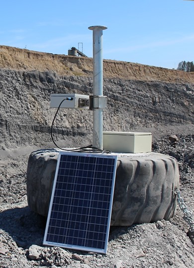
- Continuous monitoring of unstable slopes and geoinfrastructures using low-cost in-house stereo vision system
- Development of cost-effective and accurate smart solutions for real-time continuous monitoring
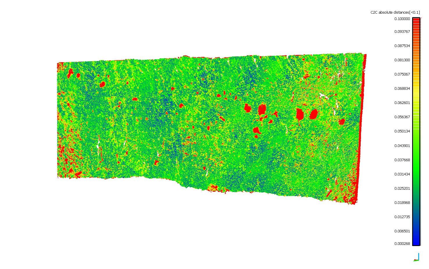
- Development of change detection algorithms for estimating slope movements and surface changes
- Development of novel strategies to efficiently integrate real-time monitoring with numerical models
- Investigation of the effect of extreme climatic conditions and climate change on instabilities through accurate spatial data
APPLICATIONS
- Cost-effective monitoring and implementation of efficient and accurate early warning systems
- Advance the understanding of the failure mechanisms in slopes and geoinfrastructures
- Quantitative hazard and risk assessment incorporating monitoring data
Enquiries

Enquiries
-
Centre Administrator
prcgse@newcastle.edu.au
The University of Newcastle acknowledges the traditional custodians of the lands within our footprint areas: Awabakal, Darkinjung, Biripai, Worimi, Wonnarua, and Eora Nations. We also pay respect to the wisdom of our Elders past and present.