Pioneering drone technology to protect Australia’s wildlife
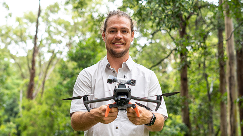
Dr Ryan Witt
Conservation scientist Dr Ryan Witt and his team are tracking and mapping cryptic species—from using thermal drones to locate koalas and greater gliders to tagging squirrel gliders. Their work is advancing wildlife protection and helping guide more informed environmental decisions.
Making wildlife count: drones, data and a clearer path for conservation
Ryan is a conservation scientist driven by one key goal—ensuring Australia’s threatened wildlife is seen, counted and considered in the decisions that shape their future.
As a researcher at the University of Newcastle, Ryan leads a small team of early career researchers developing cutting-edge drone-based monitoring tools that make it harder for species to be overlooked—and easier for governments, industry and communities to make informed, accountable choices.
“If wildlife isn’t showing up in the data, it’s not showing up in the decisions,” Ryan says.
“That’s why our work is about improving visibility, strengthening the evidence—and, hopefully, helping keep the process surrounding wildlife impacts honest.”
A childhood curiosity that never left
Really, Ryan says, you can blame his parents.
Growing up in the suburbs of Newcastle, his mum nurtured his curiosity by taking him to wildlife parks and encouraging hands-on experiences with native animals like wallabies. His dad took him bushwalking through urban reserves like Glenrock, helping him notice the quiet, everyday wonders of the bush. He also spent countless evenings feeding possums on the back deck.
“They’re the reason I do what I do,” he says.
“They gave me the chance to connect with nature, and that’s what set this whole journey in motion.”
That early passion led Ryan into a PhD in marsupial reproductive biology, working on assisted breeding techniques for native species. But over time, his focus shifted toward the field—where habitat loss and landscape change demanded faster, scalable tools to detect and protect species before they disappear.
Drones that bring wildlife into focus
Since 2019, Ryan has led the development of a thermal drone survey method to detect and monitor hard-to-find species like koalas, greater gliders and squirrel gliders.
These animals are especially vulnerable to land clearing due to their site fidelity—their tendency to return to the same trees year after year.
“If those trees go, often so do they,” Ryan says.
The method Ryan’s team developed enables real-time detection using spotlight-equipped drones, and supports population estimates across entire landscapes—a level of accuracy and scale rarely possible with traditional methods.
An early proof-of-concept for detecting koalas with drones was co-developed with the NSW Government. But the operational method used today—including real-time detection and population estimation—was developed and field-tested by Ryan’s team, with core support from WWF-Australia, and further support from Taronga Conservation Society, FAUNA Research Alliance, The Margaret Middleton Fund, Paddy Pallin Foundation , MNCJO Koala Recovery Partnership and Hunter Water Corporation.
From better data to better decisions
Now in use across NSW, the method is referenced in key frameworks like the NSW Koala Strategy and the Biodiversity Assessment Method. What sets it apart is its ability to directly detect animals at scale—providing reliable data to inform planning, development and conservation efforts.
“It’s not about stopping any particular project—it’s about making sure decisions are made with a more complete picture,” Ryan says.
“If the data is strong and consistent, the decisions that follow are hopefully better for wildlife.”
Ryan’s team also tracks species like squirrel gliders and koalas to better understand how they use fragmented habitats. By combining GPS collars, ecological modelling, nest box monitoring and genetic tools, they’re gathering vital data on movement, health, and population structure—insights that help guide conservation actions from the urban forests of Newcastle to the national parks of NSW.
Collaboration with purpose
While Ryan leads the research team, he emphasises the role of his team and their shared commitment.
“This is definitely not a solo effort, I’m incredibly proud of the early career scientists I work with,” he says.
“Their expertise, creativity, and care for the work has taken this from an idea to something that’s making real change.”
Working across disciplines, the team brings together expertise in ecology, spatial modelling, drone operations and data science—combining practical fieldwork with technical innovation.
The small team collaborates widely—with government departments, environmental NGOs, industry and community conservation groups—ensuring the science is accessible, scalable and useful across sectors.
Keeping wildlife in the frame
At its heart, Ryan’s work is about giving wildlife a stronger voice in the decisions that affect them. It’s about making threatened species impossible to overlook.
“We’re working to make sure species don’t disappear because no one knew they were there,” he says.
“Good data keeps the conversation honest—and helps everyone do better.”
From backyard possums to conservation policy, Dr Ryan Witt and his team are using drone technology and ecological data to build a future where Australia’s iconic wildlife are seen, valued, and protected—before it’s too late.

The University of Newcastle acknowledges the traditional custodians of the lands within our footprint areas: Awabakal, Darkinjung, Biripai, Worimi, Wonnarua, and Eora Nations. We also pay respect to the wisdom of our Elders past and present.