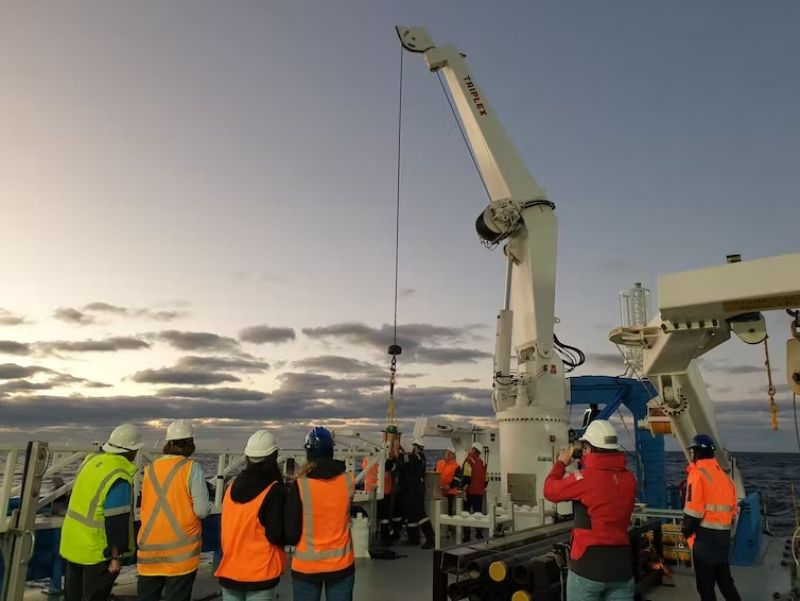
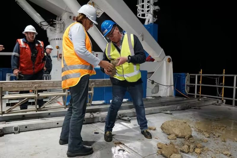
We gathered at the edge of the ship deck, awaiting the return of our sediment corer that had been lowered 4.5 kilometres – half the height of Mount Everest – to the seafloor. Our team of 53 people nervously shuffled together like penguins as we speculated about what we’d find.
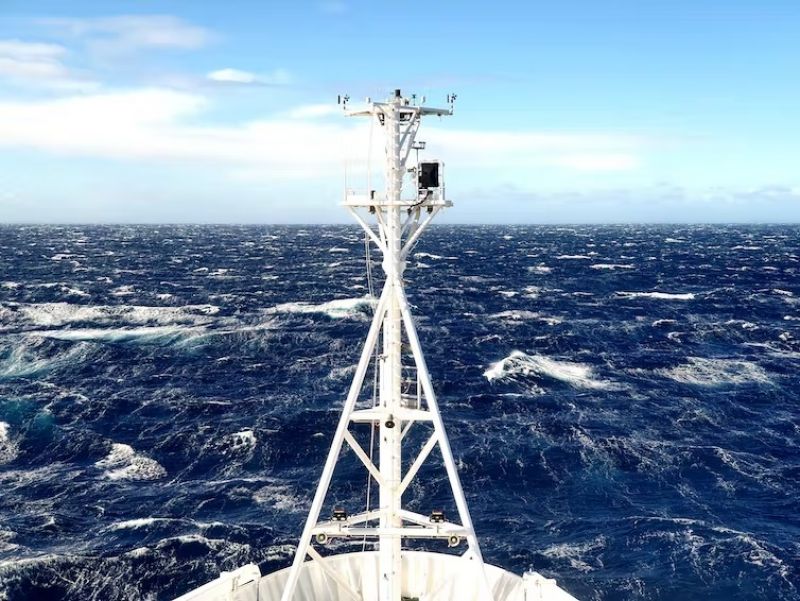
It was July 2022. We’d been at sea for 36 days on CSIRO’s Research Vessel Investigator to explore the edges of our continent and learn how it evolved through time. While we’re all familiar with the shape of modern Australia, our continental mass actually extends well beyond our shorelines.
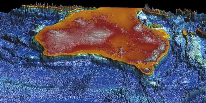
Over the 36 days of our voyage, we mapped more than 40,000 square kilometres of the seafloor from as shallow as 22 metres to depths of over 4.8km. And we’ve created 3D visualisations of features never seen before.
The steel corer emerged from the deep glistening like pirate treasure. It marks just one of many samples we collected at sea. Analysing them all will probably take years, but we can still share exciting new maps of the seafloor and what they may reveal – from the threat of tsunami in Australia to evidence of ancient beaches and dunes.
The threat of tsunami
Our research voyage aimed to investigate how mud and sand flows from our continent into the deep oceans. Along the way, these different sediments can travel down submarine canyons and form large landslides.
Sometimes, these submarine landslides are large enough to trigger a tsunami – so we’re also working to understand what the local tsunami risk is for Australia’s eastern seaboard communities.
A big part of understanding the potential threat of tsunami is learning how the material from the submarine landslides along the eastern seaboard has moved down into the deep ocean. For example, does it go as a single, large slab of sediment, failing all at once? Or does it slowly break apart, with smaller pieces heading down slope one at a time as a slurry of sediment and water?
While Australia has a relatively low tsunami risk compared to other places around the world, we are still exposed and so should heed warnings from emergency services.
A recent tsunami to hit Australia was caused by the underwater volcanic explosion in Tonga in January last year. This brought waves of more than 80 centimetres to the Gold Coast, which could knock you off your feet.
Related Articles

A shift in energy
With 17 Hunter Valley mines set to close over the next 20 years, the region is facing a significant turning point. Conversations often centre around job losses, but what comes next for those who will remain?
Read more

The secret lives of Sugarloaf koalas
“Tree stars” in the night sky revealed a hidden koala colony, nestled deep within Sugarloaf’s bushland.
Read more
Tackling the chemicals we can’t see: PFAS
PFAS contamination is persistent, but so is the determination of scientists working on solutions to remediate it.
Read more

Why are sunsets so pretty in winter? There’s a simple explanation
If you live in the southern hemisphere and have been stopped in your tracks by a recent sunset, you may have noticed they seem more vibrant lately.
Read more
Air is an overlooked source of nutrients - evidence shows we can inhale some vitamins
You know that feeling you get when you take a breath of fresh air in nature? There may be more to it than a simple lack of pollution.
Read more

Bold climate action benefits more than just the environment - it's also great for business
As the world grapples with the intensifying challenges of climate change, businesses are under increasing pressure to take action.
Read more
Mapping the seafloor surface
We mapped areas of the seafloor with a level of precision not available to previous generations of hydrographers and map-makers in Australia. Some areas were nearly 5km deep and over 100 nautical miles from the coast.
To do this, we use a multibeam system. This involves sending out sound waves from the bottom of the ship in a wide cone-shape. These sound waves bounce off the seafloor back to the ship, giving us information about the depth of the seafloor and allowing us to map any features on its surface.
One feature we remapped was an area of the continental slope offshore of Yamba, New South Wales. Here we see cliffs up to a few hundred metres high – evidence of slope failure and sliding.
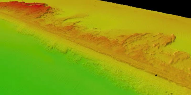
We also remapped the scar from the Bulli submarine landslide, which is the biggest submarine landslide identified on the Australian continental margin to date. At over 25km long and over 10km wide, the Bulli landslide off Wollongong in NSW removed 40 cubic kilometres of sediment from the edge of our continent.
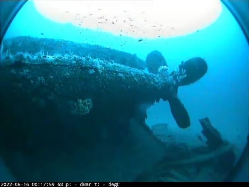
But to get a true feel for the multibeam system’s capabilities, we also mapped the wreck of the Limerick, a ship sunk by Japanese submarines off Australia’s east coast near Cape Byron in 1943. This also supported efforts to understand the current state of the famous shipwreck.
The wreck sits upside down in about 80m of water. To get a better view, we also lowered a camera to the torpedo hole in the side that sunk the ship.

Beneath the seafloor
Understanding what’s on the surface of the seafloor tells us a lot about what has happened over the last few hundreds of thousands of years.
But looking below the surface at the sediment layers beneath can tell us how the seafloor has evolved over millions of years.
To do this, we use techniques that send out pulses of sound that can penetrate the seafloor. These pulses then listen for return signals that bounce off interfaces of different types of sediments and rocks.
Through these sub-surface imaging techniques, we have identified a range of interesting features. These include extinct river channels that were previously above the sea surface when sea levels were much lower in the past.
But to really tie things down we need physical samples of the seafloor and the sediment beneath it. Doing this is a challenge when you’re floating kilometres above the seafloor you want to sample.
So we use deep sea sediment corers and dredges, lowered down on winches with kilometres of cable. Corers punch into the seafloor and bring us back a column of sediment, while dredges drag along the bottom pulling up bits of mud and rocks, bringing them on board in big chain baskets.
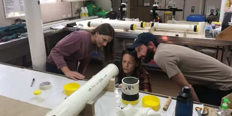
Once on board, these samples are carefully analysed to look for key features that will help us piece together the puzzle of the continental margin’s evolution. Further work, such as radiocarbon dating and isotope analysis, is conducted in the months to years after the voyage to complete the analysis.
We’ve collected some fascinating new data that will keep us busy for years to come, but we also had time for table tennis competitions, a few movie nights, and a daily debate on which of the many delicious meals onboard was the favourite.
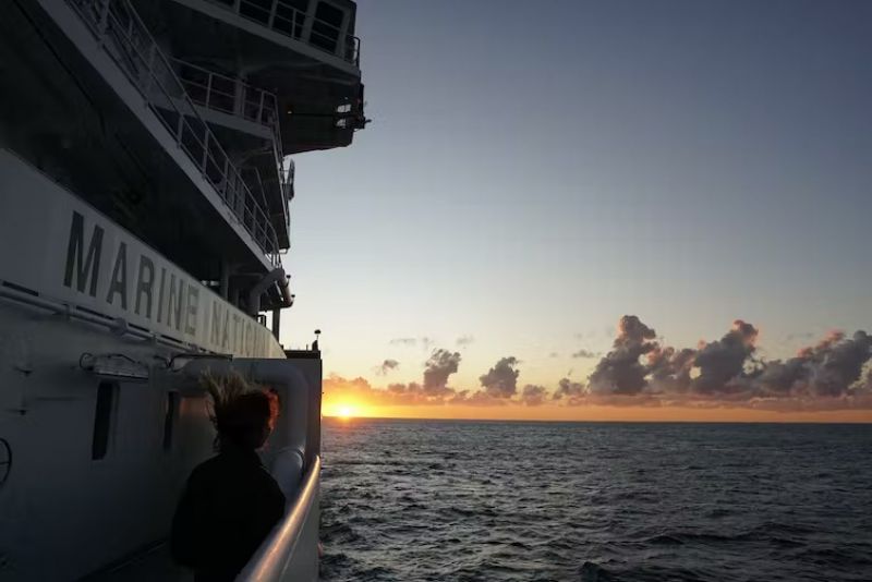
And we can’t forget the many spectacular sunrises and sunsets!
This article is republished from The Conversation under a Creative Commons license. Read the original article.
Aligned with the United Nations Sustainable Development Goals