University news
Menu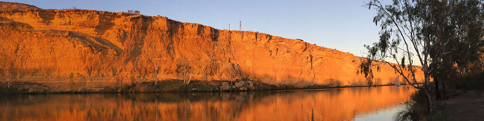
Historic lake could be key to better management of Murray Darling Basin
Sediment from Australia’s most important river basin – the Murray Darling Basin – has revealed crucial information that could be key to ensuring effective natural resource management in the face of climate change and sea-level rise.
A team of scientists - from the University of Newcastle and the University of Sydney - has published important findings revealing that between 5000 and 8000 years ago when sea-levels were approximately two metres higher than today, the Lower Murray River turned into a large, lake-like body of water.
The geological investigation, published today in Scientific Reports, examined and analysed samples of the sediment deposited within the area that would have formed the pre-historic lake, and found what the research team thinks is an invaluable long-term record of floods and flows on the Murray Darling River.
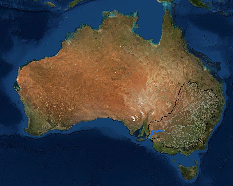
Map of the Murray-Darling Basin (black outline) and its main tributaries (grey lines) highlighting the Lower Murray River (blue). Map: H Power.
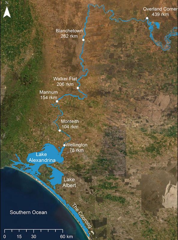
Map of the Lower Murray River showing key locations and distances upstream of the Murray mouth (as measured by following the line of the river). Map: H Power.
Dr Hannah Power from the University of Newcastle said that the findings were key to ensuring effective management of this critical river basin under future climate change scenarios.
“As our climate changes and sea levels rise, scientists are working hard to forecast what environments such as rivers and estuaries around the world would look like under a future scenario with higher sea levels and, in Australia, more intense droughts and floods,” said Dr Power.
“One way to do this is to look back to a period 5000-8000 years ago, known as the Holocene Highstand, when sea levels were higher than they are today and examine what sort of paleoenvironments were present.
What we have discovered has the potential to provide an in-depth climate history for the Murray Darling Basin over the last 8000 years.
To understand what the Holocene Highstand environment of the Lower Murray River looked like, the team used a combination of high resolution three-dimensional computer modelling and analysis of a sediment core (30 metres long) collected from within the Lower Murray Gorge on reclaimed farmland (between Wellington and Blanchetown in the Riverlands and Murray Lands of South Australia).
The research team created models to compare the historic and modern-day water depths and extents in the Lower Murray River and also detailed examples of the layering in the sediments collected from the historic lake to show how the system recorded a climate signal.
The lake, named “Lake Mannum” or “Palaeolake Mannum”, would have stretched from Wellington and the modern-day Lake Alexandrina to at least Walker Flat, a distance of 240 kilometres from the mouth of the Murray and perhaps even further upstream.
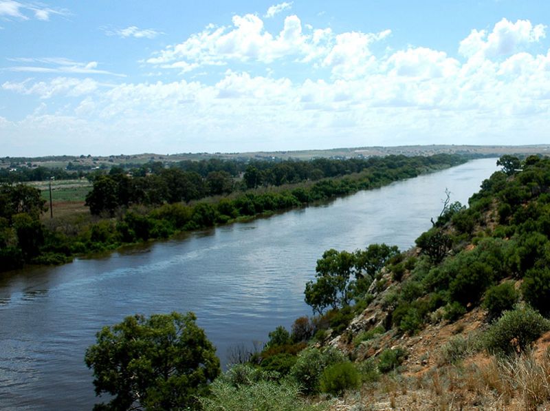
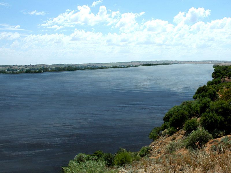
The modern day Lower Murray River. Photo: T Hubble.
A computer generated image of what Lake Mannum might have looked like. Figure: K Sentas.
Associate Professor Thomas Hubble from the University of Sydney said the ability of the Lower Murray River to trap sediment transported through the Murray Darling Basin means that this sediment provides a record of floods and droughts in the Basin as different types and volumes of sediment are deposited during different flow regimes.
“Much of the sediment underlying the present-day fringing swamps and floodplain was not deposited by a meandering river as has been generally assumed but was more probably deposited on the floor of Lake Mannum during the Holocene Highstand,” said A/Professor Hubble.
“These sediments are very finely layered, and other work we have done shows that each individual layer probably represents individual flood events on the Murray and the Darling Rivers, as well as the annual river flow-peak generated by the yearly melting of the snow-pack that accumulates on the ‘Australian Alps’ around Mt Kosciuszko in NSW and Mt Bogong in Victoria.”
As sea levels decreased to modern levels over the last 5000 years, the lake slowly drained, and as it turned back into a river it started to cut down into the sediments that were laid down during the time of Lake Mannum, eroding into the finely layered sediment.
“This makes the modern Lower Murray River very different from most other modern rivers which typically have channels that deposit sediments rather than channels that cut away into layers of previously deposited material,” said PhD student Dr Anna Helfensdorfer who led the investigation.
Throughout this time, the modern-day fringing swamps and floodplains formed, and Lakes Alexandrina and Albert emerged as distinct lakes.
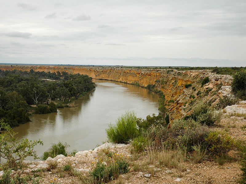
The gorge confined Lower Murray River. Photo: T Hubble.
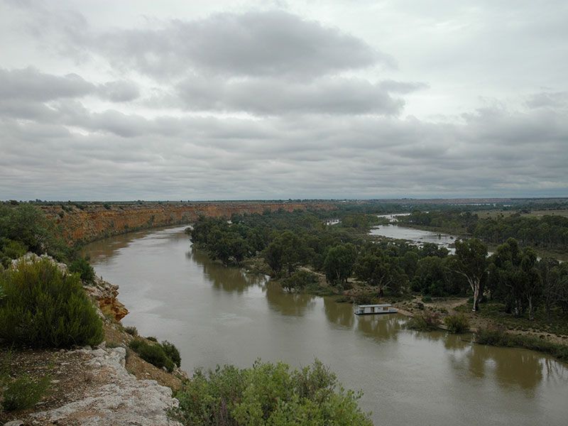
The gorge confined Lower Murray River and fringing swamps. Photo: T Hubble.
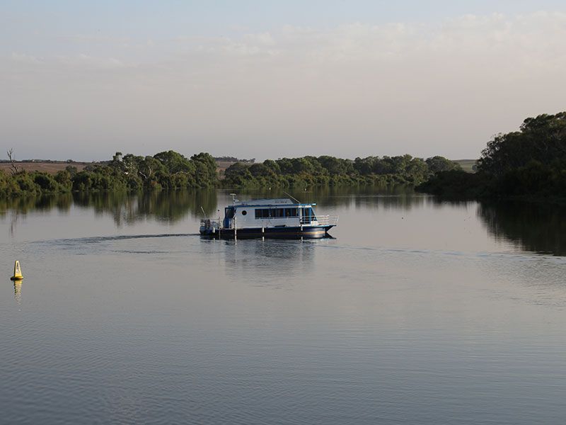
Multibeam surveying the Murray River.
Dr Power said the reason the findings of the team’s study is of such interest is that the modern-day Murray River is an intensively managed system with barrages (artificial barriers) to keep the water in the lower lakes fresh and to allow significant volumes of water to be removed for irrigation.
“While the way we manage this system may not change anytime in the near future, our research gives us an insight into what could happen under future sea level rise should we decide to remove the barrages,” said Dr Power.
“More importantly, however, the sediments deposited in Lake Mannum provide us with an invaluable record of floods and droughts in the Murray Darling Basin.”
Associate Professor Hubble said this may allow the team to obtain a reliable, detailed and high-resolution climate history for Australia’s most important river basin.
This is a key piece of knowledge to ensure we manage our biggest river basin as effectively as possible.
This particular investigation was led by recently completed PhD student Anna Helfensdorfer from the School of Geosciences at the University of Sydney and supervised by Dr Hannah Power from the University of Newcastle and Associate Professor Tom Hubble from the University of Sydney. This work is part of a larger project investigating lower Murray River channel changes during the past 10,000 years being undertaken at the University of Newcastle and the University of Sydney.
The University of Newcastle acknowledges the traditional custodians of the lands within our footprint areas: Awabakal, Darkinjung, Biripai, Worimi, Wonnarua, and Eora Nations. We also pay respect to the wisdom of our Elders past and present.