Massacre Map Presentations to Canberra Audiences
Professor Lyndall Ryan, the leader of the team behind the Colonial Frontier Massacres Map has recently delivered several presentations in Canberra.
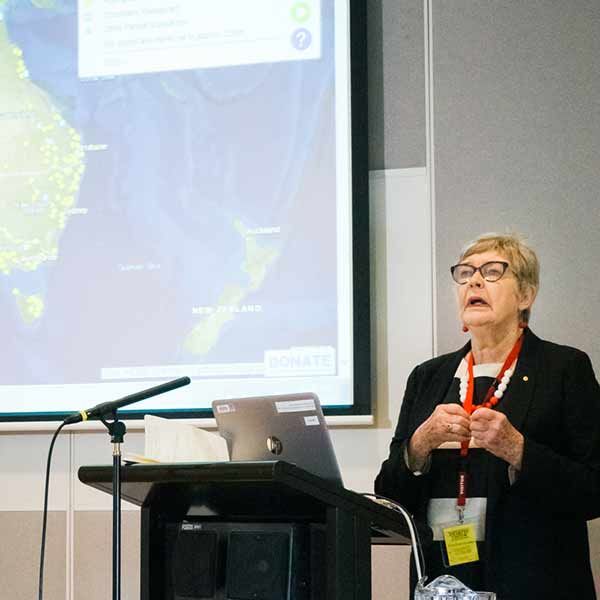
The purpose of the map is to identify and record sites of frontier massacres of Aboriginal and non-Aboriginal people across Australia 1788–1930. The map also establishes a coherent methodology to interrogate the wide array of sources and provides a reliable resource for researchers.
Lyndall recently delivered a presentation as part of the Vital Issues Seminars and Parliamentary Library Lectures. The Vital Issues Program is a series of seminars organised by the Parliamentary Library for the benefit of Senators and Members. The aim of the seminar program is to bring notable speakers to the Parliament to give Senators, Members and their staff the opportunity to hear, firsthand, expert opinion on a range of currently relevant topics. View a recording of the presentation.
Lyndall also delivered the Manning Clark House Lecture to an audience of 250 at the National Library of Australia. Following this, she gave a presentation to the Business and Economic History Conference at the Australian National University in Canberra.
Lyndall said the presentations generated important questions from the audiences.
“They included the importance of Trove as an online resource to investigate the evidence of massacres, the impact of frontier massacres on the survivors and how the statistics of massacres could be part of new research on estimating the Aboriginal population of Australia in 1788. Many in the audience were familiar with the map and considered that it had an important role to play in reshaping the way Australians understand the past,” she said.
“If members of the public have knowledge of massacres we invite them to contact us.”
The researchers behind the map have scoured Australian Newspapers on Trove, British Parliamentary Papers, Colonial Parliament Reports, explorer’ and surveyors’ journals, shipping logs, settler diaries and correspondence, Published Aboriginal accounts, oral and visual to find evidence of the massacres.
“The map is available to the public and informs public debate about colonial frontier violence. The team has found evidence for colonial frontier massacres in Australia in a wide range of sources including print, archival, oral and visual sources.”
“An initial report in a newspaper of a violent incident is often denied or glossed over at the time. Despite the denial, the research team has a date and a location for a possible massacre. Then several decades later, a perpetrator or a survivor might provide details of the massacre to a local historian, a newspaper reporter, an anthropologist, a traveller, or write about it in a memoir. The need to tell is an important factor in massacre research,” Lyndall said.
“It can take several weeks or months to track down the evidence of a massacre. The researcher needs to immerse themselves in the circumstances surrounding the massacre, the preconditions, the actual event and the aftermath.”
The map currently identifies 311 sites of massacre that occurred between 1788–1930 with an estimate of 8226 Aboriginal and Torres Strait Island victims. Stage 4, the final stage of the map is due for release in late 2020 and it’s expected the final map will identify 350-400 massacre sites.
“The project will conclude with Stage 4 in late 2020. Ongoing maintenance may include corrections and some additions thereafter.”
Related news
- Shanae’s passion for caring delivers her dream to work in health
- Food and nutrition degree serves Keren a rewarding career
- Kicking goals on and off the field, Joeli proves you can do it all
- Proving age is just a number, Arlyn wants to inspire more women in their 50s to pursue education
- Sky’s the limit for graduates on the Central Coast
The University of Newcastle acknowledges the traditional custodians of the lands within our footprint areas: Awabakal, Darkinjung, Biripai, Worimi, Wonnarua, and Eora Nations. We also pay respect to the wisdom of our Elders past and present.