
Associate Professor In-Young Yeo
Associate Professor
School of Engineering
- Email:in-young.yeo@newcastle.edu.au
- Phone:(02) 4921 6055
Where land and water intertwine
Associate Professor In-Young Yeo’s work is helping to improve natural resource management, safeguarding our earth’s most precious assets and creating greater sustainability for this generation and the next.

Associate Professor In-Young Yeo’s work lies at the nexus between our landscapes and our water resources, examining how precious natural assets such as soil, water and wetlands are being used and managed by communities.
Her research uses sophisticated remote sensing and modelling tools, and evidence-based numerical methods, to predict environmental states and challenges, tackle problems at the source and surrounds, and deliver information for better water and land resource planning, asset management, and agricultural practices.
Associate Professor Yeo’s overarching goal is to improve natural resource sustainability through better management practices that consider climate change, development pressure, and other environmental and social constraints.
“I believe that science can help us to own our behaviors and bring us together to work towards a better way to share our resources and take responsibility for them,” says Associate Professor Yeo.
Muddying the waters
Growing up in South Korea, Associate Professor Yeo saw firsthand how rapid industrialisation and urbanisation could result in drastic environmental changes over a very short period of time – and have lasting impacts.
“Over just a few years, water quality became an important concern in South Korea. People complained about the quality of their drinking water and reported health issues.
“They started paying for bottled drinking water, which was once considered ridiculous. The inaccessibility of clean water for domestic uses or farming became a problem, but little attention was paid.”
Naturally curious and inspired by the injustices and challenges she had witnessed, Associate Professor Yeo travelled to the USA to launch a research career and become part of the solution.
“I was intrigued by the idea that science and technology, such as satellite images and geographical information systems, could show where the problems come from, how they spread and move across landscapes, who might be responsible, what could be done, where and when.
“When I came to the USA to study, I learned that many developed countries had experienced similar environmental issues and were resolving some of these problems with science-informed policies.”
It wasn’t long before Associate Professor Yeo’s work was also contributing to more robust land and water management policies. Her PhD research, which looked at optimising land development patterns within economic and environmental constraints, developed a series of key sustainability principles that helped inform sustainable land use zoning and water resources management policy, along with the implementation of green infrastructure for coastal regions.
Working together
At the heart of Associate Professor Yeo’s research approach is a commitment to collaboration: working with experts across various disciplines, from industry partners to government and fellow researchers, to create solutions that work in the real world.
One of her collaborative research projects, which supported the US Conservation Effects Assessment Project (CEAP), is considered by many to be the most effective and widely adapted conservation practice to improve groundwater quality in the north-east USA.
The project, conducted with the US Department of Agriculture, US Geological Survey, and other federal and state governments, showed the effectiveness of cover crops to improve soil productivity and water quality.
“Our work helped the farmers to make better decisions for their croplands and the government to target critical areas and practices for providing incentives and subsidies.”
Mapping complex ecosystems
Associate Professor Yeo’s team have pioneered a way to map complex ecosystems, such as wetlands, again to the support the CEAP as well as the US Environmental Protection Agency (EPA), with NASA/USDA funding.
Their mapping project significantly improved the US Government’s ability to update national wetland inventory and monitor the landscape conditions and functioning across scales, under climate change and development pressure.
Their follow-on studies, using field-based research and numerical modelling, have since demonstrated cumulative benefits of wetlands and the hydrological connectivity with landscapes and groundwater.
“This provided the underpinning science to support the protection for ‘isolated’ wetlands and temporary waterways, which are contentiously not currently protected in the USA. Such findings provide the basis for continuing debates on water policy and calls for changes in current legislations.”
Australian landscapes from space
Associate Professor Yeo’s research has now been extended here in Australia – in partnership with researchers from Soil CRC, CSIRO, other Australian Universities and international space agencies – to provide insights into soil moisture, crop growth and water usage based on satellite and ground observations.
“This is really building our current capability to rapidly monitor the environment across the scales and bring this information to enhance knowledge and prediction with different sets of observations and models.
“This research direction requires new thinking and interdisciplinary teamwork – which is challenging but really exciting!
“We want to capture important issues in policymaking, compliances, and management practices around the problem of water scarcity and food security, and come up with sensible solutions that can be easily adapted by the government sectors for their management and operations.”
For example, Associate Professor Yeo and her team hope to build an integrated monitoring and forecasting system that delivers information quickly to the public to assist with smarter uses of resources and decision making.
“Such a system could assist the farmers to make smart, efficient decision on a daily basis. It could help us to better understand the impacts of environmental flows and improve the water sharing plan and the wetland inventory in Australia.”
Across all her work, Associate Professor Yeo is committed to seeing research insights translate into practical solutions and better outcomes for end users – and, importantly, for our environment.
“I see the important nature of my research, and how it can make a difference in the real world, and in our daily lives, and that keeps me going.”

Where land and water intertwine
Associate Professor In-Young Yeo’s work is helping to improve natural resource management, safeguarding our earth’s most precious assets and creating greater sustainability for this generation and the next.
Career Summary
Biography
In-Young Yeo is an Associate Professor of Civil, Surveying, and Environmental Engineering at the University of Newcastle (UoN). Prior to joining UoN in 2015, she taught at the Ohio State University, Cornell University, and University of Maryland (USA).
In-Young is primarily interested in understanding the interface of land and water systems where the human and physical systems interact and evolve together. Her research focuses on elucidating the drivers, changes, consequences and feedback loops between these two systems, under the climate changes and human development pressure. She has worked with catchment hydrology, water resources and land system modelling, remote sensing of hydrology and land surface monitoring, and spatial optimization and data analytics. She pioneers the integrative uses of remote sensing, in-situ data, and process-based or statistical models to understand the emergent land surface properties and hydrologic processes, predict their change dynamics, and provide site-specific science-based advice to guide sustainable resources management. Her work demonstrates the water cycle changes from the river basin to sub-paddock scale, remote sensing of water resources and plant water uses, downscaling of soil moisture and terrestrial water storage, the surface-ground water and soil moisture-stream flow connectivity, soil and water quality implications of conservation management practices, and optimal land use management strategies for environmental sustainability.
In-Young is a well-rounded civil and environmental engineer, geospatial analyst, and regional environmental planner. She has formal education background and professional experiences in the area of Civil and Environmental Engineering (Water Resources Engineering, Hydrology, Water Quality Processes), Geodetic and Geographical Sciences (Geographical Information Science/Remote Sensing), and City and Regional Planning (Environmental Planning, Systems Analysis and Optimization). With broad educational training and working experience, she has developed and taught a number of courses at both undergraduate and graduate levels. Previously she led the program redesign and development of BEng/MPEng in Surveying and Geospatial Engineering at UoN for the Faculty of Engineering and Built Environment (FEBE), significantly contributed to the development of the Professional Master Program in Geospatial Information Sciences (University of Maryland, USA), and served as University Delegate to the Consortium of Universities for the Advancement of Hydrologic Science, Inc. (CUAHSI, USA) and to the University Consortium of Geographic Information Science (UCGIS, USA). She is currently on the educational committee with the Surveying & Spatial Sciences Institute (SSSI) NSW.
In-Young has actively collaborated with a number of research scientists around the world and led multiple interdisciplinary research projects funded by the governments (ARC, NASA, NOAA, USDA) and industry partners (Soil CRC, and Sydney Water). In-Young was a science team member to NASA-LCLUC (as project lead) and NASA-GRACE program through international open competition, highly selective expert groups pioneering earth system observations and applications, and invited to join the G20 initiative for agricultural monitoring through earth observation systems, GEOGLAM-RAPP under UN-Environment Programme (UNEP), two national projects led by US Department of Agriculture as an international partner investigator, and the CRC for High Performance Soils as a nominated scientist. She was a recipient of the US National Oceanic Atmospheric Administration (NOAA) graduate research fellowship and received two UoN’s fellowships in recognition of excellent research. She provides professional services to the science communities and government agencies as a proposal assessor and invited expert, and a referee and an editorial board member for several professional journals.
Research Expertise
- Agriculture Hydrology and Crop Monitoring
- Climate - Food - Water Nexus
- Spatial Hydrology, Catchment System Modelling, and Water Quality Processes
- Geographical Information Systems and Remote Sensing
- Spatial Optimization and Decision Analyses
- Environmentally Sustainable Engineering and Environmental Planning
- Land and Water Resources Management
Teaching Experience
- Land Surface Processes and Management (graduate and undergraduate level)
- Physical Hydrology (undergraduate level)
- Watershed System, Modelling, and Policy (graduate level)
- Water Quality Processes and Treatment (graduate and undergraduate level)
- Quantitative Methods and Statistics (undergraduate level)
- Spatial Statistics and Spatial Data Analysis (graduate level)
- Decision Analyses and Optimization (graduate level)
- Spatial Modelling and GIS (graduate level)
- Geographic Information Systems and Remote Sensing (graduate and undergraduate level)
- Introduction to Environmental Planning (graduate level)
- Introduction to Environmental Engineering and Environmental Sciences (graduate level)
- Introduction to Urban and Regional Planning (undergraduate level)
- Physical Site Design and Planning (graduate level)
Highlighted International Collaboration
Agriculture, soil and water resource research on the international map
==================================================================================
Ph.D. Scholarship Available for International and Domestic Students
We are inviting prospective students to apply for PhD scholarships immediately available at Civil, Surveying, and Environmental Engineering, University Newcastle.
The research opportunities are available to: (1) improve the estimates of land surface variables (e.g., soil moisture, crop water uses, etc) and key soil performance indicators in agricultural setting; and (2) assess the health of natural or managed ecosystems and/or rapidly monitor flooding and inundation. These research projects will involve applying an integrated remote sensing (multi-sensor approach), a range of different spatial databases, field data, and/or process based numerical models to understand and predict the landscape change dynamics and properties across scales, and developing novel sensing techniques and data retrieval algorithms. Research projects related to agricultural applications will be sponsored by Soil CRC and contribute to best farming practices and soil management for end users.
Experiences with remote sensing and GIS, (spatial) data analytics, process based numerical model (e.g., land surface process model, flood model, crop model), field based research, and/or scientific computing are highly desirable. Evidence of excellent writing skills (e.g., publication) and English proficiency is required to be considered for the scholarship opportunity.
Interested students are welcome to contact In-Young Yeo (In-Young.Yeo@newcastle.edu.au) for more information and to see here(https://www.newcastle.edu.au/study/research) for details on how to apply.
Qualifications
- Doctor of Philosophy, Ohio State University - USA
Keywords
- Climate Change
- Environmental Engineering
- Environmental Planning and Sustainability
- Geographic Information Systems and Remote Sensing
- Hydrology
- Land Use Sciences
- Landscape Ecology
- Nonpoint Source Water Pollution
- Spatial Optimisation and Decision Sciences
- Spatial Sciences
- Water Quality
- Water Resources
Languages
- English (Fluent)
- Korean (Mother)
Fields of Research
| Code | Description | Percentage |
|---|---|---|
| 370704 | Surface water hydrology | 25 |
| 400513 | Water resources engineering | 25 |
| 401302 | Geospatial information systems and geospatial data modelling | 50 |
Professional Experience
UON Appointment
| Title | Organisation / Department |
|---|---|
| Associate Professor | University of Newcastle School of Engineering Australia |
Academic appointment
| Dates | Title | Organisation / Department |
|---|---|---|
| 5/1/2015 - 31/12/2018 | Senior Lecturer | Faculty of Engineering and Built Environment, University of Newcastle School of Engineering Australia |
| 1/9/2006 - 1/1/2015 | Assistant Professor | University of Maryland, College Park United States |
| 1/1/2006 - 31/5/2006 | Visiting Assistant Professor | Cornell University, USA United States |
| 1/8/2004 - 31/12/2005 | Lecturer | The Ohio State University United States |
| 1/6/2002 - 31/5/2004 | National Graduate Research Fellow | National Oceanic and Atmospheric Administration(NOAA) The Estuarine Research Federation United States |
| 1/1/2001 - 31/5/2002 | Graduate Research Associate | Ohio Supercomputer Center United States |
| 1/1/1998 - 31/12/2000 | Graduate Research and Teaching Associate | The Ohio State University Civil and Environmental Engineering and Geodetic Science United States |
Awards
Award
| Year | Award |
|---|---|
| 2018 |
2018 International Research Visiting Fellowship The University of Newcastle | Australia |
| 2017 |
2017 Women in Research Fellowship The University of Newcastle |
| 2013 |
Faculty Travel Support Award UMD Advance Program for Inclusive Excellence - National Science Foundation |
| 2006 |
Barclay Jones Dissertation Award for 2006 (Best Disseration in Planning) - Runner up Association of Collegiate Schools of Planning |
| 2005 |
Jerrold R. Voss Scholarship Ohio State University |
| 2004 |
Summer Dissertation Research Award, Environmental Policy Initative Ohio State University |
| 2002 |
Best Student Project Award Ohio State University |
| 2002 |
NOAA-NERR Graduate Research Fellowship (02-04) NOAA |
Member
| Year | Award |
|---|---|
| 2001 |
Honor Society of Phi Kappa Phi Honor Society of Phi Kappa Phi |
Recognition
| Year | Award |
|---|---|
| 2021 |
Science Note - USDA NRCS Conservation Effects Assessment Project (Project Lead - Headwater Wetlands Buffer Variability in Water Levels and Ecosystem Services at the Catchment Scale) US Department of Agriculture Natural Resources Conservation Service |
| 2009 |
Editor's Highlights - AGU Geophysical Research Letters American Geophysical Union |
| 2007 |
Highlighted NOAA National Estuarine Research Reserve Program Graduate Research Fellow National Oceanic and Atmospheric Administration(NOAA) The Estuarine Research Federation |
Scholarship
| Year | Award |
|---|---|
| 2004 |
Environemntal Policy Initiative Graduate Student Travel Award Ohio State University |
| 2003 |
US NOAA Graduate Student Travel Award NOAA |
| 2003 |
US National Science Foundation (NSF) Graduate Student Travel Award NSF and NASA |
Teaching
| Code | Course | Role | Duration |
|---|---|---|---|
| CIVL 3431 |
Land Surface Process and Management Faculty of Engineering and Built Environment - The University of Newcastle (Australia) Brings together a general understanding of environmental physics, acquisition and use of environmental data and numerical modelling of transport of particles and nutrients. Students will gain experience with several management tools for addressing environmental degradation, focusing on erosion and salinity |
Lecturer and Course Coordinator | 1/8/2015 - 31/12/2021 |
| SURV2650 |
Spatial Data Systems and Remote Sensing Faculty of Engineering and Built Environment - The University of Newcastle (Australia) This course will provide students with basic concepts of geographical information sciences and remote sensing. It will include types of spatial information, database structures, analytical methods for spatial data analysis, and image processing. Student will be exposed to a range of remotely sensed products and spatial data systems used for a wide range of environmental applications. Students will have hands on experience in the use of Geographical Information Systems and Remote Sensing software packages. |
Lecturer and Course Coordinator | 1/8/2015 - 1/1/2030 |
Publications
For publications that are currently unpublished or in-press, details are shown in italics.
Chapter (1 outputs)
| Year | Citation | Altmetrics | Link | ||
|---|---|---|---|---|---|
| 2017 |
Lang M, Yeo I, Beeson P, Anderson M, 'Section 4: Remote Sensing of Groundwater Resources', National Groundwater Inventorying and Monitoring Technical Guide, US Forest Service, Washingon DC (2017)
|
Journal article (62 outputs)
| Year | Citation | Altmetrics | Link | ||||||||
|---|---|---|---|---|---|---|---|---|---|---|---|
| 2024 |
Bretreger D, Hancock GR, Lowry J, Senanayake I, Yeo I-Y, 'The Impacts of Burn Severity and Frequency on Erosion in Western Arnhem Land, Australia', Sensors, 24 2282-2282
|
||||||||||
| 2024 |
Brakhasi F, Walker JP, Judge J, Liu P-W, Shen X, Ye N, et al., 'A Comparison of Passive Microwave Emission Models for Estimating Brightness Temperature at L- and P-Bands Under Bare and Vegetated Soil Conditions', IEEE Journal of Selected Topics in Applied Earth Observations and Remote Sensing, 17 2570-2585 (2024)
|
||||||||||
| 2023 |
Brakhasi F, Walker JP, Ye N, Wu X, Shen X, Yeo I-Y, et al., 'Towards soil moisture profile estimation in the root zone using L- and P-band radiometer observations: A coherent modelling approach', Science of Remote Sensing, 7 100079-100079 (2023) [C1]
|
Nova | |||||||||
| 2023 |
Senanayake IP, Yeo I-Y, Kuczera GA, 'A Random Forest-Based Multi-Index Classification (RaFMIC) Approach to Mapping Three-Decadal Inundation Dynamics in Dryland Wetlands Using Google Earth Engine', REMOTE SENSING, 15 (2023) [C1]
|
Nova | |||||||||
| 2023 |
Khaki M, Han S, Ghobadi-Far K, Yeo I, Tangdamrongsub N, 'Assimilation of GRACE Follow-On Inter-Satellite Laser Ranging Measurements Into Land Surface Models', Water Resources Research, 59 (2023) [C1]
|
Nova | |||||||||
| 2022 |
Bretreger D, Yeo I-Y, Hancock G, 'Quantifying irrigation water use with remote sensing: Soil water deficit modelling with uncertain soil parameters', Agricultural Water Management, 260 (2022) [C1]
|
Nova | |||||||||
| 2022 |
Gibson AJ, Hancock GR, Healy E, Lindsay L, Moore K, Bretreger D, et al., 'Limitations to the soil impacts of tree regrowth in improved cattle pasture', AGRICULTURE ECOSYSTEMS & ENVIRONMENT, 337 (2022) [C1]
|
Nova | |||||||||
| 2022 |
Shen X, Walker JP, Ye N, Wu X, Brakhasi F, Boopathi N, et al., 'Evaluation of the tau-omega model over bare and wheat-covered flat and periodic soil surfaces at P- and L-band', Remote Sensing of Environment, 273 (2022) [C1] It has been over ten years since the successful launch of the first-ever dedicated satellite for global soil moisture monitoring; Soil Moisture and Ocean Salinity (SMOS). Looking ... [more] It has been over ten years since the successful launch of the first-ever dedicated satellite for global soil moisture monitoring; Soil Moisture and Ocean Salinity (SMOS). Looking towards the future, P-band (0.3¿1 GHz) is a promising technique to replace or enhance the L-band (1.4 GHz) SMOS and SMAP (Soil Moisture Active Passive) missions because of an expected reduction in roughness and vegetation impact, leading to an improved soil moisture accuracy over rougher soil surfaces and more densely vegetated areas. Accordingly, this investigation evaluated the tau-omega model at P-band (0.75 GHz) using a tower-based experiment in Victoria, Australia, where brightness temperature observations were collected concurrently at P- and L-band over bare and wheat-covered flat and periodic soil surfaces. The potential to retrieve soil moisture without discriminating periodic and flat surfaces was investigated by applying the roughness and vegetation parameters calibrated for flat soil to retrieve the moisture of periodic soil. Results showed that P-band had a comparable RMSE across different roughness configurations (variations less than 0.016 m3/m3) for both bare and wheat-covered soil, while the L-band RMSE was only comparable for wheat-covered soil, indicating that periodic surfaces did not need to be discriminated in such scenarios. Conversely, a difference of 0.022 m3/m3 was observed for L-band with bare soil. A reduced vegetation impact was also demonstrated at P-band, with an RMSE of 0.029 m3/m3 achieved when completely ignoring the wheat existence with under 4-kg/m2 vegetation water content, whereas at L-band the RMSE increased to 0.063 m3/m3. This study therefore paves the way for a successful P-band radiometer mission for obtaining more accurate global soil moisture information.
|
Nova | |||||||||
| 2022 |
Yin W, Zhang G, Han S-C, Yeo I-Y, Zhang M, 'Improving the resolution of GRACE-based water storage estimates based on machine learning downscaling schemes', Journal of Hydrology, 613 128447-128447 (2022) [C1]
|
Nova | |||||||||
| 2022 |
Senanayake IP, Yeo I-Y, Hancock GR, Willgoose GR, 'A decadal record of soil moisture space-time variability over a south-east Australian catchment', HYDROLOGICAL PROCESSES, 36 (2022) [C1]
|
Nova | |||||||||
| 2022 |
Bretreger D, Hancock G, Yeo I-Y, Martinez DC, Wells DT, Cox T, et al., 'Comparing the reliability of two soil moisture probes for high clay content NSW soils', Water e-Journal, 8 1-17 [C1]
|
Nova | |||||||||
| 2022 |
Shen X, Walker JP, Ye N, Wu X, Brakhasi F, Boopathi N, et al., 'Impact of random and periodic surface roughness on P- and L-band radiometry', Remote Sensing of Environment, 269 (2022) [C1] L-band passive microwave remote sensing is currently considered a robust technique for global monitoring of soil moisture. However, soil roughness complicates the relationship bet... [more] L-band passive microwave remote sensing is currently considered a robust technique for global monitoring of soil moisture. However, soil roughness complicates the relationship between brightness temperature and soil moisture, with current soil moisture retrieval algorithms typically assuming a constant roughness parameter globally, leading to a potential degradation in retrieval accuracy. This current investigation established a tower-based experiment site in Victoria, Australia. P-band (~40-cm wavelength/0.75 GHz) was compared with L-band (~21-cm wavelength/1.41 GHz) over random and periodic soil surfaces to determine if there is an improvement in brightness temperature simulation and soil moisture retrieval accuracy for bare soil conditions, due to reduced roughness impact when using a longer wavelength. The results showed that P-band was less impacted by random and periodic roughness than L-band, evidenced by more comparable statistics across different roughness conditions. The roughness effect from smooth surfaces (e.g., 0.8-cm root-mean-square height and 11.1-cm correlation length) could be potentially ignored at both P- and L-band with satisfactory simulation and retrieval performance. However, for rougher soil (e.g., 1.6-cm root-mean-square height and 6.8-cm correlation length), the roughness impact needed to be accounted for at both P- and L-band, with P-band observations showing less impact than L-band. Moreover, a sinusoidal soil surface with 10-cm amplitude and 80-cm period substantially impacted the brightness temperature simulation and soil moisture retrieval at both P- and L-band, which could not be fully accounted for using the SMOS and SMAP default roughness parameters. However, when retrieving roughness parameters along with soil moisture, the ubRMSE at P-band over periodic soil was improved to a similar level (0.01-0.02 m3/m3) as that of smooth flat soil (0.01 m3/m3), while L-band showed higher ubRMSE over the periodic soil (0.03-0.04 m3/m3) than over smooth flat soil (0.01 m3/m3). Accordingly, periodic roughness effects were reduced by using observations at P-band.
|
Nova | |||||||||
| 2021 |
Senanayake IP, Yeo I-Y, Walker JP, Willgoose GR, 'Estimating catchment scale soil moisture at a high spatial resolution: Integrating remote sensing and machine learning', Science of The Total Environment, 776 (2021) [C1]
|
Nova | |||||||||
| 2021 |
Nan Y, Walker J, Yeo I-Y, Jackson T, Kerr Y, Kim E, et al., 'Toward P-Band Passive Microwave Sensing of Soil Moisture', IEEE Geoscience and Remote Sensing Letters, 18 504-508 (2021) [C1]
|
Nova | |||||||||
| 2021 |
Lee S, Qi J, McCarty GW, Yeo IY, Zhang X, Moglen GE, Du L, 'Uncertainty assessment of multi-parameter, multi-GCM, and multi-RCP simulations for streamflow and non-floodplain wetland (NFW) water storage', Journal of Hydrology, 600 (2021) [C1] In this study, we assessed the impacts of uncertainties arising from hydrologic model parameters and climate change data on streamflow and catchment-level non-floodplain wetland (... [more] In this study, we assessed the impacts of uncertainties arising from hydrologic model parameters and climate change data on streamflow and catchment-level non-floodplain wetland (NFW) water storage predictions for the Coastal Plain of the Chesapeake Bay watershed. The hydrologic model used in this study was the Soil and Water Assessment Tool (SWAT) coupled with improved wetland modules. Model uncertainty was represented using 12 parameter sets (PARs) with acceptable model performance. Different projections of future climate conditions (eight global circulation models [GCMs] under three representative concentration pathways [RCPs]) were used to represent climate change uncertainty. The ensemble method and analysis of variance were adopted for uncertainty assessment. The results showed that monthly streamflow projections did not substantially differ with respect to individual PARs, GCMs, and RCPs; by contrast, the projected NFW water storage varied significantly. However, the changes in projected hydrological values relative to historic conditions greatly differed with regard to the PARs, GCMs, and RCPs, leading to a high uncertainty in assessing climate change impacts. The variability of GCM projections was the most significant single contributor, accounting for 46% and 49% of the total streamflow and NFW water storage projection uncertainties, respectively, followed by PARs and RCPs. Our work assessed the impacts of different uncertainty sources on NFW hydrology under climate change, suggesting careful consideration of model and climate change uncertainties for the reliable projections of NFW hydrologic behaviors.
|
Nova | |||||||||
| 2021 |
Khaki M, Han SC, Yeo IY, Frost A, 'The Application of CYGNSS Data for Soil Moisture and Inundation Mapping in Australia', IEEE Journal of Selected Topics in Applied Earth Observations and Remote Sensing, 14 10395-10404 (2021) [C1] Cyclone global navigation satellite system (CYGNSS) has provided a valuable opportunity for high spatiotemporal monitoring of land surface reflectivity over the past few years. CY... [more] Cyclone global navigation satellite system (CYGNSS) has provided a valuable opportunity for high spatiotemporal monitoring of land surface reflectivity over the past few years. CYGNSS with a constellation of eight microsatellites is able to constantly observe the 'scattered' global positioning system signals from the land. In this study, we validate the CYGNSS land reflectivity data in Australia for mapping the spatial extent of the inundated area and for determining temporal changes in surface soil moisture. CYGNSS level 1 data acquired for the period of 2017-2020 is assessed against various measurements, including satellite and ground-based measurements. Empirical mode decomposition is used to better analyze the CYGNSS time series and their relationship with the independent measurements. Furthermore, the mission's ability to capture surface reflectivity changes in response to extreme climatic events is analyzed. The results show that high spatial and temporal resolution CYGNSS data can largely represent the top layer ($\sim$5 cm) soil moisture spatial and temporal variations close to soil moisture active passive. CYGNSS surface reflectivity results are also found to be sensitive to surface water changes and able to depict inundated land surface.
|
Nova | |||||||||
| 2021 |
Han SC, Yeo IY, Khaki M, McCullough CM, Lee E, Sauber J, 'Novel Along-Track Processing of GRACE Follow-On Laser Ranging Measurements Found Abrupt Water Storage Increase and Land Subsidence During the 2021 March Australian Flooding', Earth and Space Science, 8 (2021) [C1] Following extreme drought during the 2019¿2020 bushfire summer, the eastern part of Australia suffered from a week-long intense rainfall and extensive flooding in March 2021. Unde... [more] Following extreme drought during the 2019¿2020 bushfire summer, the eastern part of Australia suffered from a week-long intense rainfall and extensive flooding in March 2021. Understanding how much water storage changes in response to these climate extremes is critical for developing timely water management strategies. To quantify prompt water storage changes associated with the 2021 March flooding, we processed the low-latency (1¿3¿days), high-precision intersatellite laser ranging measurements from GRACE Follow-On spacecraft and determined instantaneous gravity changes along spacecraft orbital passes. Such new data processing detected an abrupt surge of water storage approaching 60¿70 trillion liters (km3 of water) over a week in the region, which concurrently caused land subsidence of ~5¿mm measured by a network of ground GPS stations. This was the highest speed of ground water recharge ever recorded in the region over the last two decades. Compared to the condition in February 2020, the amount of recharged water was similar but the recharge speed was much faster in March 2021. While these two events together replenished the region up to ~80% of the maximum storage over the last two decades, the wet antecedent condition of soils in 2021 was distinctly different from the dry conditions in 2020 and led to generating extensive runoff and flooding in 2021.
|
Nova | |||||||||
| 2021 |
Han SC, Ghobadi-Far K, Yeo IY, McCullough CM, Lee E, Sauber J, 'GRACE Follow-On revealed Bangladesh was flooded early in the 2020 monsoon season due to premature soil saturation', Proceedings of the National Academy of Sciences of the United States of America, 118 (2021) [C1] The overall size and timing of monsoon floods in Bangladesh are challenging to measure. The inundated area is extensive in low-lying Bangladesh, and observations of water storage ... [more] The overall size and timing of monsoon floods in Bangladesh are challenging to measure. The inundated area is extensive in low-lying Bangladesh, and observations of water storage are key to understanding floods. Laser-ranging instruments on Gravity Recovery and Climate Experiment (GRACE) Follow-On spacecraft detected the peak water storage anomaly of 75 gigatons across Bangladesh in late July 2020. This is in addition to, and three times larger than, the maximum storage anomaly in soil layers during the same period. A flood propagation model suggested that the water mass, as shown in satellite observations, is largely influenced by slow floodplain and groundwater flow processes. Independent global positioning system measurements confirmed the timing and total volume of the flood water estimates. According to land surface models, the soils were saturated a month earlier than the timing of the peak floodplain storage observed by GRACE Follow-On. The cyclone Amphan replenished soils with rainfall just before the monsoon rains started, and consequently, excessive runoff was produced and led to the early onset of the 2020 flooding. This study demonstrated how antecedent soil moisture conditions can influence the magnitude and duration of flooding. Continuous monitoring of storage change from GRACE Follow-On gravity measurements provides important information complementary to river gauges and well levels for enhancing hydrologic flood forecasting models and assisting surface water management.
|
Nova | |||||||||
| 2021 |
Bretreger D, Yeo IY, Kuczera G, Hancock G, 'Remote sensing's role in improving transboundary water regulation and compliance: The Murray-Darling Basin, Australia', Journal of Hydrology X, 13 (2021) [C1] Growing agricultural water demand is dramatically affecting the implementation of, and compliance with, water sharing plans in regions such as the Murray-Darling Basin (MDB). Prob... [more] Growing agricultural water demand is dramatically affecting the implementation of, and compliance with, water sharing plans in regions such as the Murray-Darling Basin (MDB). Problems can arise from water theft, poor resourcing or questionable actions from stakeholders. Recent actions from MDB governments have resulted in improved regulation, although more is required in a technical, governance and cultural space to create a comprehensive and transparent management framework. This is pivotal in improving overall trust in water regulators. We discuss an integrated water resource management approach for improved water regulation, involving the implementation of remote sensing technologies to complement metering, coupled with a focus on a stronger compliance culture in a range of stakeholder groups and regulatory changes that allow quicker adoption of unbiased best practice science and technology.
|
Nova | |||||||||
| 2021 |
Senanayake IP, Yeo I-Y, Willgoose GR, Hancock GR, 'Disaggregating satellite soil moisture products based on soil thermal inertia: a comparison of a downscaling model built at two spatial scales', Journal of Hydrology, 594 (2021) [C1]
|
Nova | |||||||||
| 2021 |
Bretreger D, Yeo I-Y, Melchers R, 'Terrain wetness indices derived from LiDAR to inform soil moisture and corrosion potential for underground infrastructure', SCIENCE OF THE TOTAL ENVIRONMENT, 756 (2021) [C1]
|
Nova | |||||||||
| 2021 |
Shen X, Walker JP, Ye N, Wu X, Boopathi N, Yeo IY, et al., 'Soil Moisture Retrieval Depth of P- And L-Band Radiometry: Predictions and Observations', IEEE Transactions on Geoscience and Remote Sensing, 59 6814-6822 (2021) [C1] The moisture retrieval depth is commonly held to be the approximately top 5 cm at L-band (21-cm wavelength/1.41 GHz), which is seen as a limitation for hydrological applications. ... [more] The moisture retrieval depth is commonly held to be the approximately top 5 cm at L-band (21-cm wavelength/1.41 GHz), which is seen as a limitation for hydrological applications. A widely held view is that this moisture retrieval depth increases with wavelength, ranging approximately from one-tenth to one-fourth of the wavelength. Accordingly, P-band (40-cm wavelength/0.75 GHz) is under investigation for soil moisture observation over a deeper layer of soil. However, there is no accepted method for predicting the moisture retrieval depth, and there has been no study to confirm that the actual retrieval depth at P-band is indeed deeper than that achieved at L-band. Consequently, this research has estimated the moisture retrieval depth from theory and compared with empirical evidence from tower-based observations. Model predictions and experimental observations agreed that P-band has the potential to retrieve soil moisture over a deeper layer (7 cm) than L-band (5 cm) while maintaining the same correlation. However, an alternate interpretation of experimental results is that P-band has a larger correlation with soil moisture (accuracy of retrieval) than L-band but for the same 5-cm moisture retrieval depth. The results also demonstrated the increasing trend of the moisture retrieval depth for increasing wavelength, with the potential to achieving a moisture retrieval depth greater than 10 cm for P-band below 0.5 GHz. Importantly, model predictions showed that moisture retrieval depth was not only dependent on soil moisture content and observation frequency, but also the moisture gradient of the profile.
|
Nova | |||||||||
| 2020 |
Hively WD, Lee S, Sadeghi AM, McCarty GW, Lamb BT, Soroka A, et al., 'Estimating the effect of winter cover crops on nitrogen leaching using cost-share enrollment data, satellite remote sensing, and Soil and Water Assessment Tool (SWAT) modeling', Journal of Soil and Water Conservation, 75 362-375 (2020) [C1]
|
Nova | |||||||||
| 2020 |
Stubbs Q, Yeo I-Y, Lang M, Townshend J, Sun L, Prestegaard K, Jantz C, 'Assessment of Wetland Change on the Delmarva Peninsula from 1984 to 2010', JOURNAL OF COASTAL RESEARCH, 36 575-589 (2020) [C1]
|
||||||||||
| 2020 |
Lee S, McCarty GW, Moglen GE, Lang MW, Nathan Jones C, Palmer M, et al., 'Seasonal drivers of geographically isolated wetland hydrology in a low-gradient, Coastal Plain landscape', Journal of Hydrology, 583 (2020) [C1]
|
Nova | |||||||||
| 2020 |
Bretreger D, Yeo I-Y, Melchers R, 'LiDAR derived terrain wetness indices to infer soil moisture above underground pipelines', International Journal on Smart Sensing and Intelligent Systems, 13 1-7 (2020) [C1]
|
Nova | |||||||||
| 2020 |
Lang MW, Kim V, McCarty GW, Li X, Yeo I-Y, Huang C, Du L, 'Improved Detection of Inundation below the Forest Canopy using Normalized LiDAR Intensity Data', Remote Sensing, 12 (2020) [C1]
|
Nova | |||||||||
| 2020 |
Tangdamrongsub N, Han SC, Yeo IY, Dong J, Steele-Dunne SC, Willgoose G, Walker JP, 'Multivariate data assimilation of GRACE, SMOS, SMAP measurements for improved regional soil moisture and groundwater storage estimates', Advances in Water Resources, 135 (2020) [C1]
|
Nova | |||||||||
| 2020 |
Bretreger D, Yeo I-Y, Hancock G, Willgoose G, 'Monitoring irrigation using landsat observations and climate data over regional scales in the Murray-Darling Basin', Journal of Hydrology, 590 (2020) [C1]
|
Nova | |||||||||
| 2020 |
Lee S, Yen H, Yeo IY, Moglen GE, Rabenhorst MC, McCarty GW, 'Use of multiple modules and Bayesian Model Averaging to assess structural uncertainty of catchment-scale wetland modeling in a Coastal Plain landscape', Journal of Hydrology, 582 (2020) [C1]
|
Nova | |||||||||
| 2020 |
Yin W, Han S-C, Zheng W, Yeo I-Y, Hu L, Tangdamrongsub N, Ghobadi Far K, 'Improved water storage estimates within the North China Plain by assimilating GRACE data into the CABLE model', Journal of Hydrology, 590 (2020) [C1]
|
Nova | |||||||||
| 2019 |
Lee S, Yeo IY, Lang MW, McCarty GW, Sadeghi AM, Sharifi A, et al., 'Improving the catchment scale wetland modeling using remotely sensed data', Environmental Modelling and Software, 122 (2019) [C1]
|
Nova | |||||||||
| 2019 |
Senanayake I, Yeo I-Y, Tangdamrongsub N, Willgoose G, Hancock G, Wells T, et al., 'An in-situ data based model to downscale radiometric satellite soil moisture products in the Upper Hunter Region of NSW, Australia', Journal of Hydrology, 572 820-838 (2019) [C1]
|
Nova | |||||||||
| 2019 |
Yeo IY, Lang MW, Lee S, McCarty GW, Sadeghi AM, Yetemen O, Huang C, 'Mapping landscape-level hydrological connectivity of headwater wetlands to downstream waters: A geospatial modeling approach - Part 1', Science of the Total Environment, 653 1546-1556 (2019) [C1]
|
Nova | |||||||||
| 2019 |
Yeo IY, Lee S, Lang MW, Yetemen O, McCarty GW, Sadeghi AM, Evenson G, 'Mapping landscape-level hydrological connectivity of headwater wetlands to downstream waters: A catchment modeling approach - Part 2', Science of the Total Environment, 653 1557-1570 (2019) [C1]
|
Nova | |||||||||
| 2019 |
Lee S, McCarty GW, Moglen GE, Lang MW, Sadeghi AM, Green TR, et al., 'Effects of subsurface soil characteristics on wetland-groundwater interaction in the coastal plain of the Chesapeake Bay watershed', Hydrological Processes, 33 305-315 (2019) [C1]
|
Nova | |||||||||
| 2019 |
Bretreger D, Yeo I-Y, Quijano J, Awad J, Hancock G, Willgoose G, 'Monitoring irrigation water use over paddock scales using climate data and landsat observations', Agricultural Water Management, 221 175-191 (2019) [C1]
|
Nova | |||||||||
| 2019 |
Yen H, Park S, Arnold JG, Srinivasan R, Chawanda CJ, Wang R, et al., 'IPEAT+: A built-in optimization and automatic calibration tool of SWAT+', Water, 11 (2019) [C1]
|
Nova | |||||||||
| 2018 |
Sangchul L, Yeo I, Sadeghi A, McCarty G, Hively W, Lang M, Sharifi A, 'Comparative analyses of hydrological responses of two adjacent watersheds to climate variability and change using the SWAT model', Hydrology and Earth System Sciences, 22 689-708 (2018) [C1]
|
Nova | |||||||||
| 2018 |
Lee S, Sadeghi AM, McCarty GW, Baffaut C, Lohani S, Duriancik LF, et al., 'Assessing the suitability of the Soil Vulnerability Index (SVI) on identifying croplands vulnerable to nitrogen loss using the SWAT model', Catena, 167 1-12 (2018) [C1]
|
Nova | |||||||||
| 2018 |
Lee S, Yeo I-Y, Lang MW, Sadeghi AM, McCarty GW, Moglen GE, Evenson GR, 'Assessing the cumulative impacts of geographically isolated wetlands on watershed hydrology using the SWAT model coupled with improved wetland modules', Journal of Environmental Management, 223 37-48 (2018) [C1]
|
Nova | |||||||||
| 2018 |
Tangdamrongsub N, Han S-C, Decker M, Yeo I, Kim H, 'On the use of GRACE normal equation of intersatellite tracking data for improved estimation of soil moisture and groundwater in Australia', Hydrology and Earth System Sciences, 22 1811-1829 (2018) [C1]
|
Nova | |||||||||
| 2018 |
Lee S, Wallace CW, Sadeghi AM, McCarty GW, Zhong H, Yeo I, 'Impacts of Global Circulation Model (GCM) bias and WXGEN on Modeling Hydrologic Variables', Water, 10 (2018) [C1]
|
Nova | |||||||||
| 2017 |
Jin HR, Huang CQ, Lang MW, Yeo IY, Stehman SV, 'Monitoring of wetland inundation dynamics in the Delmarva Peninsula using Landsat time-series imagery from 1985 to 2011', Remote Sensing of Environment, 190 26-41 (2017) [C1]
|
Nova | |||||||||
| 2017 |
Lee S, Sadeghi AM, Yeo IY, McCarty GW, Hively WD, 'Assessing the impacts of future climate conditions on the effectiveness of winter cover crops in reducing nitrate loads into the chesapeake bay watersheds using the SWAT model', Transactions of the ASABE, 60 1939-1955 (2017) [C1]
|
Nova | |||||||||
| 2016 |
Lee S, Yeo IY, Sadeghi A, McCarty G, Hively H, Lang MW, 'Impacts of Watershed Characteristics and Crop Rotations on Winter Cover Crop Nitrate-Nitrogen Uptake Capacity within Agricultural Watersheds in the Chesapeake Bay Region', PLoS One, 11 (2016) [C1]
|
Nova | |||||||||
| 2016 |
Sharifi A, Lang MW, McCarty GW, Sadeghi AM, Lee S, Yen H, et al., 'Improving model prediction reliability through enhanced representation of wetland soil processes and constrained model auto calibration A paired watershed study', Journal of Hydrology, 541 1088-1103 (2016) [C1] Process based, distributed watershed models possess a large number of parameters that are not directly measured in field and need to be calibrated, in most cases through matching ... [more] Process based, distributed watershed models possess a large number of parameters that are not directly measured in field and need to be calibrated, in most cases through matching modeled in-stream fluxes with monitored data. Recently, concern has been raised regarding the reliability of this common calibration practice, because models that are deemed to be adequately calibrated based on commonly used metrics (e.g., Nash Sutcliffe efficiency) may not realistically represent intra-watershed responses or fluxes. Such shortcomings stem from the use of an evaluation criteria that only concerns the global in-stream responses of the model without investigating intra-watershed responses. In this study, we introduce a modification to the Soil and Water Assessment Tool (SWAT) model, and a new calibration technique that collectively reduce the chance of misrepresenting intra-watershed responses. The SWAT model was modified to better represent NO3 cycling in soils with various degrees of water holding capacity. The new calibration tool has the capacity to calibrate paired watersheds simultaneously within a single framework. It was found that when both proposed methodologies were applied jointly to two paired watersheds on the Delmarva Peninsula, the performance of the models as judged based on conventional metrics suffered, however, the intra-watershed responses (e.g., mass of NO3 lost to denitrification) in the two models automatically converged to realistic sums. This approach also demonstrates the capacity to spatially distinguish areas of high denitrification potential, an ability that has implications for improved management of prior converted wetlands under crop production and for identifying prominent areas for wetland restoration.
|
Nova | |||||||||
| 2014 |
Yeo I-Y, Lee S, Sadeghi AM, Beeson PC, Hively WD, McCarty GW, Lang MW, 'Assessing winter cover crop nutrient uptake efficiency using a water quality simulation model', HYDROLOGY AND EARTH SYSTEM SCIENCES, 18 5239-5253 (2014) [C1]
|
Nova | |||||||||
| 2013 |
Yeo IY, Huang C, 'Revisiting the forest transition theory with historical records and geospatial data: A case study from Mississippi (USA)', Land Use Policy, 32 1-13 (2013) This study examines forest change processes, within the framework of forest transition theory (FTT), using Mississippi (USA) as a case study. The aim is to evaluate the assumption... [more] This study examines forest change processes, within the framework of forest transition theory (FTT), using Mississippi (USA) as a case study. The aim is to evaluate the assumption and theoretical basis of FTT with quantitative data, and to propose changes in forest management policy as a potential driver for reforestation. We compiled a number of historical records, geospatial data, and time series forest mapping products to reconstruct the last 100 years of forest trajectory. Forest changes are studied in relation to changes in society, over a range of temporal and spatial scales. Details of forest dynamics (e.g., the rate and extent of forest gain and loss) were quantified, while considering the ecological properties of the secondary forests. Mississippi forests are intensively managed and fragmented secondary forests, while regenerated entirely through plantation. The quantified forest transition (FT) curve indicated that forest dynamics have been nonlinear and have involved multiple reversals, resulting in multiple periods of forest expansion. The spatial and temporal analysis with time series remote sensing data over the last 30 years reveals that Mississippi forests have experienced very frequent changes and disturbance, even during the period of forest expansion. These change patterns are not apparent when considering total forest area estimates. The result illustrates that the " forest scarcity pathway" of FTT (Rudel et al., Global Environmental Change Part A 15(1) (2005) 23-31) worked to reverse the deforestation trend for the initial FT period. However, regenerated forests have experienced another episode of FT and expansion, and this cannot be explained by the forest scarcity pathway. Rather, the case of Mississippi suggests an alternative pathway (Mather, International Forestry Review 9(1) (2007) 491-502; Lambin and Meyfroidt, Land Use Policy 27 (2010) 108-118), distinct from the previous work, and highlights the importance of changes in policy incentives to account for forest recovery. The conceptual basis of FTT proposed by Mather (Area 24(4) (1992) 367-379) and Grainger (Area 27(3) (1995) 242-251) is revisited, showing how two alternative views are complementary, providing explanation for the repeated patterns of FT. This study presents empirical evidence to understand the theoretical basis and assumptions of FTT and suggests a new path for FT, " forest management policy pathway" © 2012 Elsevier Ltd.
|
||||||||||
| 2013 |
Lang M, McCarty G, Oesterling R, Yeo IY, 'Topographic metrics for improved mapping of forested wetlands', Wetlands, 33 141-155 (2013) We investigated the predictive strength of forested wetland maps produced using digital elevation models (DEMs) derived from Light Detection and Ranging (LiDAR) data and multiple ... [more] We investigated the predictive strength of forested wetland maps produced using digital elevation models (DEMs) derived from Light Detection and Ranging (LiDAR) data and multiple topographic metrics, including multiple topographic wetness indices (TWIs), a TWI enhanced to incorporate information on water outlets, normalized relief, and hybrid TWI/relief in the Coastal Plain of Maryland. LiDAR DEM based wetland maps were compared to maps of inundation and existing wetland maps. TWIs based on the most distributed FD8 (8 cells) and somewhat distributed D8 (1-2 cells) flow routing algorithms were better correlated with inundation than a TWI based on a non-distributed D8 (1 cell) flow routing algorithm, but D8 TWI class boundaries appeared artificial. The enhanced FD8 TWI provided good prediction of wetland location but could not predict periodicity of inundation. Normalized relief provided good prediction of inundation periodicity but was less able to map wetland boundaries. A hybrid of these metrics provided good measurement of wetland location and inundation periodicity. Wetland maps based on topographic metrics included areas of flooded forest that were similar to an aerial photography based wetland map. These results indicate that LiDAR based topographic metrics have potential to improve accuracy and automation of wetland mapping. © 2012 US Government.
|
||||||||||
| 2013 |
Yeo IY, Huang C, 'Forest dynamics in Mississippi, USA: A hybrid statistical and geospatial analysis', Regional Environmental Change, 13 583-599 (2013) Understanding forest changes and its trajectory is important to develop policy options and future scenarios for climate analysis. This research is conducted to gain insights on se... [more] Understanding forest changes and its trajectory is important to develop policy options and future scenarios for climate analysis. This research is conducted to gain insights on secondary forests change using Mississippi, USA, as a case study. We investigate the spatial patterns and temporal dynamics of secondary forests at high resolution and examine the forces driving their changes. An extensive literature review is conducted to refine the conceptual framework of forest changes and identify the underlying key factors. Forest changes are quantified at high spatial (30-m) and temporal (biennial) resolutions, using time series remotely sensed data between 1984 and 2007. A number of geospatial and socioeconomic data were compiled to analyze the spatial variations of forest disturbances and their linkages to various socioeconomic, political, and biogeophysical factors. The results show that the secondary forests are highly dynamic and variable. Disturbances and regeneration occur continuously everywhere in a systematic and coordinated fashion. This pattern prevents an extensive disturbance and increases total forest cover. Market conditions (i.e., timber price) are the key predictor of the level and overall trend of forest disturbances. However, spatial patterns of forest dynamics cannot be explained by location-specific biophysical, socioeconomic, and policy factors identified in the literature. They can best be described by the ecological characteristics of the forests (i.e., the forest type and age distribution), which have a clear economic linkage. The research shows that regenerated forests frequently experience loss and gain of their extent, and their ecological characteristics change drastically on a short-term basis. These results point out challenges and opportunities in forest management and policy with regard to reforestation. © 2012 Springer-Verlag.
|
||||||||||
| 2010 |
Han S-C, Yeo I-Y, Alsdorf D, Bates P, Boy J-P, Kim H, et al., 'Movement of Amazon surface water from time-variable satellite gravity measurements and implications for water cycle parameters in land surface models', GEOCHEMISTRY GEOPHYSICS GEOSYSTEMS, 11 (2010)
|
||||||||||
| 2010 |
Yeo I-Y, Guldmann J-M, 'Global spatial optimization with hydrological systems simulation: application to land-use allocation and peak runoff minimization', HYDROLOGY AND EARTH SYSTEM SCIENCES, 14 325-338 (2010)
|
||||||||||
| 2009 |
Han S-C, Kim H, Yeo I-Y, Yeh P, Oki T, Seo K-W, et al., 'Dynamics of surface water storage in the Amazon inferred from measurements of inter-satellite distance change', GEOPHYSICAL RESEARCH LETTERS, 36 (2009)
|
||||||||||
| 2007 |
Yeo I-Y, Guldmann J-M, Gordon SI, 'A hierarchical optimization approach to watershed land use planning', WATER RESOURCES RESEARCH, 43 (2007)
|
||||||||||
| 2006 |
Yeo I-Y, Guldmann J-M, 'Land-use optimization for controlling peak flow discharge and nonpoint source water pollution', ENVIRONMENT AND PLANNING B-PLANNING & DESIGN, 33 903-921 (2006)
|
||||||||||
| 2004 |
Yeo I-Y, Gordon SI, Guldmann J-M, 'Optimizing Patterns of Land Use to Reduce Peak Runoff Flow and Nonpoint Source Pollution with an Integrated Hydrological and Land-Use Model', EARTH INTERACTIONS, 8 (2004)
|
||||||||||
| Show 59 more journal articles | |||||||||||
Conference (59 outputs)
| Year | Citation | Altmetrics | Link | ||||||||
|---|---|---|---|---|---|---|---|---|---|---|---|
| 2023 |
Brakhasi F, Walker JP, Judge J, Liu P-W, Nan Y, Yeo I-Y, 'EVALUATING THE ACCURACY OF PASSIVE MICROWAVE EMISSION MODELS FOR ESTIMATING BRIGHTNESS TEMPERATURE', IGARSS 2023 - 2023 IEEE INTERNATIONAL GEOSCIENCE AND REMOTE SENSING SYMPOSIUM, CA, Pasadena (2023)
|
||||||||||
| 2022 |
Brakhasi F, Walker JP, Ye N, Wu X, Shen X, Yeo IY, Boopathi N, 'Root Zone Soil Moisture Profile Retrieval Using Combined L-Band and P-Band Radiometry', International Geoscience and Remote Sensing Symposium (IGARSS) (2022) [E1] Root zone soil moisture and its distribution throughout the profile play an important role in agricultural productivity and drought monitoring. An inversion scheme including the s... [more] Root zone soil moisture and its distribution throughout the profile play an important role in agricultural productivity and drought monitoring. An inversion scheme including the stratified coherent models of Njoku and Wilheit were employed to retrieve the daily soil moisture profile at 6 AM from simulated L-band and P-band radiometry observations for April 2019 in Cora Lynn, Victoria, Australia. Different levels of noise up to 4 K were imposed in this synthetic study. The average RMSE of retrieved soil moisture at the surface, middle, and bottom (60 cm) of the profile for the Njoku (Wilheit) model were 0.01 (0.04), 0.04 (0.06), and 0.05 (0.07) (all in m3/m3) when a second-order polynomial function was considered as the representative of the soil moisture profile.
|
Nova | |||||||||
| 2021 |
Quijano J, Rodriguez J, Kuczera G, Saco P, Sandi S, Carlier R, et al., 'Water regime emulation in dryland wetland systems using network linear programming with side constraints', Online (2021)
|
||||||||||
| 2019 |
Bretreger D, Yeo I-Y, 'The effects of SILO & AWRA wind speeds on irrigation depth simulations', MODSIM2019, 23rd International Congress on Modelling and Simulation, Canberra, ACT, Australia (2019) [E1]
|
Nova | |||||||||
| 2019 |
Bretreger D, Warner A, Yeo I-Y, 'Comparing remote sensing and tabulated crop coefficients to assess irrigation water use', MODSIM2019, 23rd International Congress on Modelling and Simulation., Canberra, ACT, Australia (2019) [E1]
|
Nova | |||||||||
| 2019 |
Binesh A, Yeo I-Y, Hancock G, 'Effects of soil data input on catchment streamflow and soil moisture prediction', MODSIM2019, 23rd International Congress on Modelling and Simulation., Canberra, ACT (2019) [E1]
|
Nova | |||||||||
| 2019 |
Senanayake I, Yeo I-Y, Willgoose GR, Bretreger D, 'Using an artificial neural network to enhance the spatial resolution of satellite soil moisture products based on soil thermal inertia', MODSIM2019, 23rd International Congress on Modelling and Simulation, Canberra, ACT (2019) [E1]
|
Nova | |||||||||
| 2018 |
Binesh A, Yeo I-Y, 'Multi-variable hydrological simulation in a semi-arid catchment towards effective water resources management', Hydrology and Water Resources Symposium (HWRS 2018): Water and Communities, Melbourne, VIC (2018) [E1]
|
Nova | |||||||||
| 2018 |
Ye N, Wu X, Walker J, Boopathi N, Jackson TJ, Kerr Y, et al., 'Towards multi-frequency soil moisture retrieval using P- and L-band passive microwave sensing technology', IGARSS 2018: The 38th annual symposium of the IEEE Geoscience and Remote Sensing Society (IGRSS, Valencia, Spain (2018) [E1]
|
Nova | |||||||||
| 2018 |
Boopathi N, Ye N, Walker JP, Rao YS, Jackson TJ, Kerr Y, et al., 'Toward soil moisture retrieval using tower-based P-band radiometer observations', The 38th annual symposium of the IEEE Geoscience and Remote Sensing Society (IGRSS)., Valencia, Spain (2018) [E1]
|
Nova | |||||||||
| 2018 |
Senanayake IP, Yeo IY, Willgoose GR, Hancock GR, 'Towards sub-catchment scale soil moisture prediction: A combined remote sensing and land surface modelling approach', Hydrology and Water Resources Symposium (HWRS 2018): Water and Communities, Melbourne, VIC (2018) [E1]
|
Nova | |||||||||
| 2017 |
Tangdamrongsub N, Han S, Yeo I, 'Enhancement of water storage estimates using GRACE data assimilation with particle filter framework', MODSIM2017, 22nd International Congress on Modelling and Simulation. Modelling and Simulation Society of Australia and New Zealand, Hobart, Tasmania, Australia (2017) [E1]
|
Nova | |||||||||
| 2017 |
Yeo I, Lang M, Huang C, Yetemen O, 'Evolution of wetland monitoring from inventory to functional assessment and modelling: a case study from a US catchment', The 22nd International Congress on Modelling and Simulation (MODSIM2017), Hobart, Tasmania, Australia (2017) [E1]
|
Nova | |||||||||
| 2017 |
Binesh A, Yeo I, 'Modelling changing catchment under the climate variability: a case study from a semi-arid catchment in the upper basin of the Goulburn River.', The 22nd International Congress on Modelling and Simulation (MODSIM2017), Hobart, Tasmania, Australia (2017) [E1]
|
Nova | |||||||||
| 2017 |
Senanayake I, Yeo I, Tangdamrongsub N, Willgoose G, Hancock G, Wells T, 'Disaggregation of SMAP radiometric soil moisture measurements at catchment scale using MODIS land surface temperature data', Proceedings of Research@Locate, the academic research stream at the 4th annual conference of Digital Earth & Locate, Sydney, Australia (2017) [E1]
|
Nova | |||||||||
| 2017 |
Senanayake IP, Yeo IY, Tangdamrongsub N, Willgoose GR, Hancock GR, Wells T, et al., 'Downscaling SMAP and SMOS soil moisture retrievals over the Goulburn River Catchment, Australia', Hobart, Tasmania, Australia (2017) [E1]
|
Nova | |||||||||
| 2016 |
Sadeghi A, Lee S, Yeo I, McCarty G, Lang M, 'Inclusion of Riparian Wetland Module (RWM) into the SWAT Model for Assessment of Wetland Hydrological Benefit', Quito, Ecuador (2016) [E1]
|
Nova | |||||||||
| 2005 |
Yeo IY, Guldmann JM, Gordon SI, 'Multistage hierarchical optimization for land use allocation to control nonpoint source water pollution', Proceedings of the 2005 Watershed Management Conference - Managing Watersheds for Human and Natural Impacts: Engineering, Ecological, and Economic Challenges (2005) To effectively and systematically analyze this complex spatial watershed system, a hierarchical optimization approach is proposed. A top-down land allocation scheme is applied to ... [more] To effectively and systematically analyze this complex spatial watershed system, a hierarchical optimization approach is proposed. A top-down land allocation scheme is applied to determine an optimal land allocation, and then to identify spatial locations of protected lands at a high level of spatial resolution (30 m cell). At the top level, the stormwater runoff simulation model is used to generate peak discharge pseudo data, that are input to a regression analysis, where the functional relationship between peak discharge and land-use variables is approximated as a quadratic function (R 2=0.98%). This function is then used in an optimization model to allocate future land uses (urban, conservation, and agriculture at the subwatershed/catchement level), in a way that minimizes the resulting peak discharge at the watershed outlet. Then, an integrated hydrological-land use optimization (IHLUO) model scheme is developed to (1) investigate the NFS pollution generation/transport mechanisms and spatial variability/interdependencies of land use change impacts on watershed hydrology, (2) systematically evaluate different land-use patterns and their response to rainfall, and (3) search for the optimal land-use pattern at the cell level. The results are very promising, with a 44% reduction of the peak discharge rate as compared to the rate corresponding to the current land-use pattern. The most downstream and upstream areas are to be protected with more conservation, and most urban activities are allocated to the minimal impact subwatershed. Sensitivity analyses are performed and suggest maintaining at least 30% of the land in a conservation state, developing no more than 12% for urban purposes, and no more than 70% for agricultural purposes. The proposed methodology is applied to the Old Woman Creek watershed, located in the southwestern basin of Lake Erie (Ohio).
|
||||||||||
| Show 56 more conferences | |||||||||||
Other (3 outputs)
| Year | Citation | Altmetrics | Link | |||||
|---|---|---|---|---|---|---|---|---|
| 2023 |
Yetemen O, Avcioglu A, Ozcan O, Simsek I, Kolbuken M, Yeo I-Y, et al., 'Influence of Hillslope Aspect on a Cinder Cone Evolution: The Sandal Divlit example, Kula, Turkey', Copernicus GmbH (2023)
|
|||||||
| 2022 |
Yetemen O, Avcioglu A, Celik YS, Simsek I, Kolbuken M, Yeo I-Y, et al., 'Eco-hydro-geomorphic evolution of the Sandal Divlit cinder cone, Kula, Turkey', Copernicus GmbH (2022)
|
|||||||
| 2021 |
Yeo I-Y, Lee S, Lang M, McCarty G, Yetemen O, 'Headwater wetlands buffer variability in water levels and ecosystem services at the catchment scale.', Conservation Effects Assessment Project (CEAP)-Wetlands. Washington DC: United States Department of Agriculture(USDA) Natural Resources Conservation Service(NRCS) (2021)
|
|||||||
Preprint (1 outputs)
| Year | Citation | Altmetrics | Link | |||||
|---|---|---|---|---|---|---|---|---|
| 2021 |
Lee S, McCarty GW, Moglen GE, Yen H, Lei F, Anderson M, et al., 'Enhanced Watershed Modeling by Incorporating Remotely Sensed Evapotranspiration
and Leaf Area Index (2021)
|
|||||||
Presentation (2 outputs)
| Year | Citation | Altmetrics | Link | ||
|---|---|---|---|---|---|
| 2018 |
Yeo I, 'An integrated data and model approach toward effective water resources management at the local catchment scale', (2018)
|
||||
| 2016 |
Yeo I, 'Implication of land cover characteristics and change dynamics for water resources management: Sustainable agriculture and conservation practices', (2016)
|
Report (2 outputs)
| Year | Citation | Altmetrics | Link | ||
|---|---|---|---|---|---|
| 2018 |
Yeo I, 'Final Project Report to NASA: Mapping and monitoring of wetland dynamics for improved resilience and delivery of ecosystem services in the Mid-Atlantic region', NASA, 15 (2018)
|
||||
| 2014 |
Yeo I, 'Spatial and temporal analysis of wetland change and vulnerability assessment in the Chesapeake Bay watershed', Chesapeake Bay Program s Scientific and Technical Advisory Committee (STAC), (2014)
|
Grants and Funding
Summary
| Number of grants | 22 |
|---|---|
| Total funding | $4,697,711 |
Click on a grant title below to expand the full details for that specific grant.
20232 grants / $529,034
Smart Irrigation: integrating UAV soil moisture maps & variable rate sprays$379,034
Funding body: ARC (Australian Research Council)
| Funding body | ARC (Australian Research Council) |
|---|---|
| Project Team | A/Pf In-Young Yeo, Pf Jeff Walker, Dr James Hills, Dr Ivan PopStefanija, Mr. Ivor Gaylard |
| Scheme | Linkage Projects |
| Role | Lead |
| Funding Start | 2023 |
| Funding Finish | 2026 |
| GNo | |
| Type Of Funding | C1200 - Aust Competitive - ARC |
| Category | 1200 |
| UON | N |
Geodesy, Hydroclimate and Space Weather Experiment with Skykraft Satellite Constellation$150,000
Funding body: NSW Space Research Network (SRN)
| Funding body | NSW Space Research Network (SRN) |
|---|---|
| Project Team | Professor Shin-Chan Han, Mr Craig Benson, Professor Andrew Dempster, Doctor Mehdi Khaki, Dr Eldar Rubinov, Associate Professor In-Young Yeo |
| Scheme | Research Pilot Project |
| Role | Investigator |
| Funding Start | 2023 |
| Funding Finish | 2024 |
| GNo | G2200992 |
| Type Of Funding | C2300 – Aust StateTerritoryLocal – Own Purpose |
| Category | 2300 |
| UON | Y |
20212 grants / $101,380
Visualising Australasia's Soils: extending the soil data federation$54,080
Funding body: CRC for High Performance Soils
| Funding body | CRC for High Performance Soils |
|---|---|
| Project Team | Associate Professor In-Young Yeo, Associate Professor Peter Dahlhaus, Dr David Medyckyj-Scott, Dr Hanabeth Luke |
| Scheme | Major Investment Round |
| Role | Lead |
| Funding Start | 2021 |
| Funding Finish | 2023 |
| GNo | G2101036 |
| Type Of Funding | CRC - Cooperative Research Centre |
| Category | 4CRC |
| UON | Y |
Matching soil performance indicators to farming systems$47,300
Funding body: CRC for High Performance Soils
| Funding body | CRC for High Performance Soils |
|---|---|
| Project Team | Associate Professor In-Young Yeo, Dr Catherine Allan, Associate Professor Gregory Hancock, Dr Nathan Robinson |
| Scheme | Major Investment Round |
| Role | Lead |
| Funding Start | 2021 |
| Funding Finish | 2022 |
| GNo | G2101045 |
| Type Of Funding | CRC - Cooperative Research Centre |
| Category | 4CRC |
| UON | Y |
20201 grants / $154,750
Toward Digital Mapping of Soil Moisture$154,750
Funding body: CRC for High Performance Soils
| Funding body | CRC for High Performance Soils |
|---|---|
| Project Team | Associate Professor In-Young Yeo, Associate Professor Peter Dalhalus, Mrs Sepideh Jalayer, Ms Kalani Pathira Arachchilage, Associate Professor In-Young Yeo, Associate Professor In-Young Yeo |
| Scheme | PhD Scholarship |
| Role | Lead |
| Funding Start | 2020 |
| Funding Finish | 2022 |
| GNo | G1900955 |
| Type Of Funding | CRC - Cooperative Research Centre |
| Category | 4CRC |
| UON | Y |
20192 grants / $725,141
Optimal trade-offs for managing environmental water in inland wetlands$531,957
Funding body: ARC (Australian Research Council)
| Funding body | ARC (Australian Research Council) |
|---|---|
| Project Team | Emeritus Professor George Kuczera, Associate Professor Jose Rodriguez, Associate Professor Patricia Saco, Associate Professor In-Young Yeo, Dr Li Wen, Professor Paul Bates |
| Scheme | Discovery Projects |
| Role | Investigator |
| Funding Start | 2019 |
| Funding Finish | 2021 |
| GNo | G1701530 |
| Type Of Funding | C1200 - Aust Competitive - ARC |
| Category | 1200 |
| UON | Y |
Critical Underground Pipe Sensing$193,184
Funding body: Sydney Water Corporation
| Funding body | Sydney Water Corporation |
|---|---|
| Project Team | Professor Robert Melchers, Associate Professor In-Young Yeo |
| Scheme | Research Project |
| Role | Investigator |
| Funding Start | 2019 |
| Funding Finish | 2020 |
| GNo | G1900376 |
| Type Of Funding | C2400 – Aust StateTerritoryLocal – Other |
| Category | 2400 |
| UON | Y |
20181 grants / $5,966
2018 International Visit to University of South Carolina, USA & USDA-ARS Hydrology and Remote Sensing Laboratory, USA$5,966
Funding body: University of Newcastle
| Funding body | University of Newcastle |
|---|---|
| Project Team | Associate Professor In-Young Yeo, Dr Wade Crow, Professor Venkat Lakshmi |
| Scheme | International Research Visiting Fellowship |
| Role | Lead |
| Funding Start | 2018 |
| Funding Finish | 2018 |
| GNo | G1700939 |
| Type Of Funding | Internal |
| Category | INTE |
| UON | Y |
20172 grants / $119,520
Towards P-band soil moisture sensing from space$89,520
Funding body: ARC (Australian Research Council)
| Funding body | ARC (Australian Research Council) |
|---|---|
| Project Team | Associate Professor In-Young Yeo |
| Scheme | Discovery Projects |
| Role | Lead |
| Funding Start | 2017 |
| Funding Finish | 2020 |
| GNo | G1700180 |
| Type Of Funding | C1200 - Aust Competitive - ARC |
| Category | 1200 |
| UON | Y |
To further understanding on Australian croplands and soils$30,000
Funding body: University of Newcastle
| Funding body | University of Newcastle |
|---|---|
| Project Team | Associate Professor In-Young Yeo |
| Scheme | Women in Research Fellowship |
| Role | Lead |
| Funding Start | 2017 |
| Funding Finish | 2018 |
| GNo | G1701409 |
| Type Of Funding | Internal |
| Category | INTE |
| UON | Y |
20161 grants / $2,500
Faculty Conference Travel Grant$2,500
Funding body: Faculty of Engineering and Built Environment - The University of Newcastle (Australia)
| Funding body | Faculty of Engineering and Built Environment - The University of Newcastle (Australia) |
|---|---|
| Scheme | Faculty Conference Travel Grant |
| Role | Lead |
| Funding Start | 2016 |
| Funding Finish | 2016 |
| GNo | |
| Type Of Funding | Internal |
| Category | INTE |
| UON | N |
20151 grants / $185,000
Conservation Effects Assessment Project (CEAP) - Choptank Watershed Modeling Studies$185,000
Funding body: United State Department of Agriculture (USDA)
| Funding body | United State Department of Agriculture (USDA) |
|---|---|
| Project Team | I.Y. Yeo |
| Scheme | US Department of Agriculture |
| Role | Lead |
| Funding Start | 2015 |
| Funding Finish | 2017 |
| GNo | |
| Type Of Funding | External |
| Category | EXTE |
| UON | N |
20142 grants / $936,000
Analysis of GRACE Level-1B and Level-2 Data to Advance Surface Water Hydrological Model,$715,000
Funding body: National Aeronautics and Space Administration (NASA) Gravity Recovery and Climate Experiment (GRACE) Science Team
| Funding body | National Aeronautics and Space Administration (NASA) Gravity Recovery and Climate Experiment (GRACE) Science Team |
|---|---|
| Project Team | S.-C. Han, J. Sauber, I.-Y. Yeo |
| Scheme | NASA |
| Role | Investigator |
| Funding Start | 2014 |
| Funding Finish | 2017 |
| GNo | |
| Type Of Funding | International - Competitive |
| Category | 3IFA |
| UON | N |
USDA-ARS, Assessing the effects and effectiveness of conservation practices through advanced geospatial techniques $221,000
Funding body: US Department of Agriculture - Agricultural Research Service (ARS
| Funding body | US Department of Agriculture - Agricultural Research Service (ARS |
|---|---|
| Scheme | US Department of Agriculture |
| Role | Lead |
| Funding Start | 2014 |
| Funding Finish | 2014 |
| GNo | |
| Type Of Funding | External |
| Category | EXTE |
| UON | N |
20132 grants / $32,000
Regional-scale hydrological implications of forest cover change dynamics: Midterm analysis with multi-temporal satellite data and field observation$28,500
Funding body: University of Maryland
| Funding body | University of Maryland |
|---|---|
| Scheme | University of Maryland |
| Role | Lead |
| Funding Start | 2013 |
| Funding Finish | 2014 |
| GNo | |
| Type Of Funding | Internal |
| Category | INTE |
| UON | N |
Crafting A Culture of Investment$3,500
Funding body: UMD Advance Program for Inclusive Excellence - National Science Foundation (NSF):
| Funding body | UMD Advance Program for Inclusive Excellence - National Science Foundation (NSF): |
|---|---|
| Scheme | UMD Advance Program for Inclusive Excellence - National Science Foundation (NSF): |
| Role | Lead |
| Funding Start | 2013 |
| Funding Finish | 2013 |
| GNo | |
| Type Of Funding | Internal |
| Category | INTE |
| UON | N |
20121 grants / $1,071,000
Mapping and monitoring of wetland dynamics for improved resilience and delivery of ecosystem services in the Mid-Atlantic region$1,071,000
Funding body: NASA (National Aeronautics and Space Administration)
| Funding body | NASA (National Aeronautics and Space Administration) |
|---|---|
| Project Team | I.Y. Yeo, M. Lang, C. Huang, and C. Jantz |
| Scheme | Project Grant |
| Role | Lead |
| Funding Start | 2012 |
| Funding Finish | 2016 |
| GNo | |
| Type Of Funding | International - Competitive |
| Category | 3IFA |
| UON | N |
20112 grants / $88,500
Trans-disciplinary civic engagement around visualizing climate change in Dorchester County, MD: a Pilot Study$50,000
Funding body: USDA Research, Education, and Economics Information System
| Funding body | USDA Research, Education, and Economics Information System |
|---|---|
| Project Team | V. Chanse |
| Scheme | USDA Research, Education, and Economics Information System |
| Role | Investigator |
| Funding Start | 2011 |
| Funding Finish | 2012 |
| GNo | |
| Type Of Funding | Not Known |
| Category | UNKN |
| UON | N |
Mapping and monitoring of wetland dynamics for improved resilience and delivery of ecosystem services at the landscape scale$38,500
Funding body: National Research Foundation
| Funding body | National Research Foundation |
|---|---|
| Project Team | I.-Y. Yeo, M. Lang |
| Scheme | National Research Foundation, NSF |
| Role | Lead |
| Funding Start | 2011 |
| Funding Finish | 2012 |
| GNo | |
| Type Of Funding | Not Known |
| Category | UNKN |
| UON | N |
20102 grants / $425,500
Ecosystem services provided by wetlands$397,000
Funding body: US Department of Agriculture - Agricultural Research Service (ARS | United States
| Funding body | US Department of Agriculture - Agricultural Research Service (ARS | United States |
|---|---|
| Scheme | USDA |
| Role | Lead |
| Funding Start | 2010 |
| Funding Finish | 2014 |
| GNo | |
| Type Of Funding | External |
| Category | EXTE |
| UON | N |
Integrated modeling of adaptation to climate change and other stressors at the local watershed level: the Choptank Case Study$28,500
Funding body: University of Maryland
| Funding body | University of Maryland |
|---|---|
| Scheme | University of Maryland |
| Role | Lead |
| Funding Start | 2010 |
| Funding Finish | 2011 |
| GNo | |
| Type Of Funding | Internal |
| Category | INTE |
| UON | N |
20091 grants / $321,420
Assessing trajectories, patterns and stressors in marsh loss at the landscape level$321,420
Funding body: NASA (National Aeronautics and Space Administration)
| Funding body | NASA (National Aeronautics and Space Administration) |
|---|---|
| Project Team | M. Kearney, I.Y. Yeo |
| Scheme | Project Grant |
| Role | Investigator |
| Funding Start | 2009 |
| Funding Finish | 2011 |
| GNo | |
| Type Of Funding | International - Competitive |
| Category | 3IFA |
| UON | N |
Research Supervision
Number of supervisions
Current Supervision
| Commenced | Level of Study | Research Title | Program | Supervisor Type |
|---|---|---|---|---|
| 2024 | PhD | Optimal Uses of Remote Sensing and Physical Model to Improve Hydrologic Prediction for Accurate Flood Early Warnings | PhD (Civil Eng), College of Engineering, Science and Environment, The University of Newcastle | Principal Supervisor |
| 2024 | PhD | Improve crop water management using high resolution near-surface soil moisture data | Civil Engineering, Monash University | Co-Supervisor |
| 2024 | PhD | Improve Soil Moisture Estimation Using Remote Sensing Data In Combination With Field and Model Data | PhD (Environmental Eng), College of Engineering, Science and Environment, The University of Newcastle | Principal Supervisor |
| 2023 | PhD | High-resolution root zone soil moisture mapping based on UAV surface soil moisture retrievals and data assimilation methods for precision irrigation | Environmental Engineering, Monash University | Co-Supervisor |
| 2020 | PhD | Investigating Invasive Species Distributive Threat Post-Cyclone Impact in Samoa | PhD (Environmental Sc), College of Engineering, Science and Environment, The University of Newcastle | Co-Supervisor |
| 2020 | PhD | Towards soil moisture profile retrieval using L-band and P-band radiometer observations | Civil Engineering, Monash University | Co-Supervisor |
Past Supervision
| Year | Level of Study | Research Title | Program | Supervisor Type |
|---|---|---|---|---|
| 2023 | PhD | Improved Water Resource Management through Remote Sensing: Methods to Quantify Irrigation Water Use | PhD (Environmental Eng), College of Engineering, Science and Environment, The University of Newcastle | Principal Supervisor |
| 2023 | PhD | Regenerative Agriculture: Exploring the Boundaries | Environmental Studies, Southern Cross University | Co-Supervisor |
| 2022 | PhD | Soil moisture retrieval from P-band microwave radiometer observations | Civil Engineering, Monash University | Co-Supervisor |
| 2021 | PhD | Study on the Changes of Groundwater Storage Based on GRACE Data in Northern China | PhD (Environmental Eng), College of Engineering, Science and Environment, The University of Newcastle | Co-Supervisor |
| 2020 | PhD | Estimating Soil Moisture at a High Spatial Resolution with Remote Sensing | PhD (Environmental Eng), College of Engineering, Science and Environment, The University of Newcastle | Principal Supervisor |
| 2017 | PhD | The integration of remotely sensed data into a watershed modeling approach to characterize winter cover crop nitrate uptake function and wetland inundation | Environmental Engineering, University of Maryland, College Park | Sole Supervisor |
| 2016 | PhD | A SPATIAL-TEMPORAL ANALYSIS OF WETLAND LOSS AND SECTION 404 PERMITTING ON THE DELMARVA PENINSULA FROM 1980 TO 2010 | Environmental Studies, University of Maryland, College Park | Sole Supervisor |
| 2008 | Masters | Comparing collegiate soccer and football recruiting patterns: GIS approach | Geomatic Eng Not Elswr Classif, University of Maryland, College Park | Principal Supervisor |
Research Collaborations
The map is a representation of a researchers co-authorship with collaborators across the globe. The map displays the number of publications against a country, where there is at least one co-author based in that country. Data is sourced from the University of Newcastle research publication management system (NURO) and may not fully represent the authors complete body of work.
| Country | Count of Publications | |
|---|---|---|
| Australia | 70 | |
| United States | 55 | |
| France | 11 | |
| India | 10 | |
| China | 8 | |
| More... | ||
News

News • 26 Feb 2021
Drones to predict where water pipes are at risk of bursting
With leaking and burst water pipes costing water authorities and consumers time and money, as well as wasting a precious resource, researchers at the University of Newcastle are developing drone technology to help predict which areas, and even which specific pipes, are at risk of water loss through corrosion.

News • 27 Oct 2017
Women In Research Fellowships awarded
Thirteen University of Newcastle (UON) researchers have been awarded a Women in Research (WIR) Fellowship thanks to Research Advantage.
Associate Professor In-Young Yeo
Position
Associate Professor
School of Engineering
College of Engineering, Science and Environment
Contact Details
| in-young.yeo@newcastle.edu.au | |
| Phone | (02) 4921 6055 |
| Mobile | 0449056508 |
| Links |
Research and Innovation Cluster Research and Innovation Cluster Research and Innovation Cluster YouTube YouTube YouTube SoundCloud YouTube YouTube YouTube Research Networks |
Office
| Room | EA 106 |
|---|---|
| Building | Engineering A |
| Location | Callaghan University Drive Callaghan, NSW 2308 Australia |
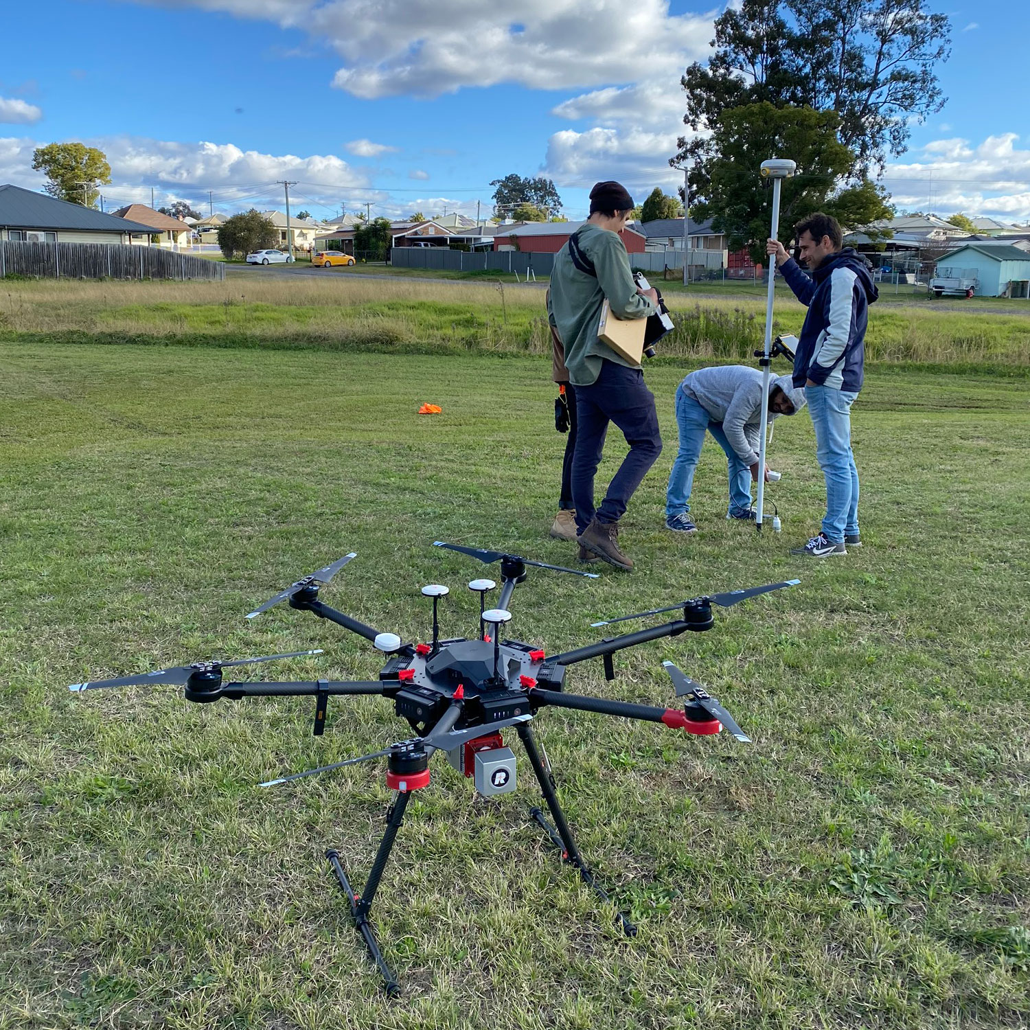
NEWS • Feb 26.2021
Drones to predict where water pipes are at risk of bursting
With leaking and burst water pipes costing water authorities and consumers time and money, as well as wasting a precious resource, researchers at the University of Newcastle are developing drone technology to help predict which areas, and even which specific pipes, are at risk of water loss.

NEWS • Oct 27.2017
Women In Research Fellowships awarded
Thirteen UON researchers have been awarded a Women in Research (WIR) Fellowship thanks to Research Advantage.